Jezioro Legińskie
| Jezioro Legińskie | ||
|---|---|---|
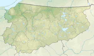
| Geographical location | In the north of the Polish Warmian-Masurian Voivodeship | |
| Drain | Direction Sajna (and on to the Guber ) | |
| Location close to the shore | Reszel | |
| Data | ||
| Coordinates | 53 ° 58 '44 " N , 21 ° 8' 17" E | |
|
|
||
| surface | 230 ha | |
| length | 2.3 km | |
| width | 2 km | |
| Maximum depth | 37.00 m | |
The Jezioro Legińskie ( German Legiener See ) is a lake in northern Poland in the Warmian-Masurian Voivodeship .
The village of Leginy is located north of the lake , Łężany Cegielnia to the east , and Łężany to the south-east . In the east of the Jezioro Legińskie runs the voivodship road 590. With an area of 230 hectares, it is one of the largest lakes in the Gmina Reszel . The lake has a maximum depth of 37 meters, some bays have a maximum depth of only 1.5 meters. There is a small island in the lake. The bottom of the lake is sandy and overgrown.
The name of the lake changed several times, in 1331 it was called Sprohe , 1353 Sproyn , 1359 Sproge , 1404 Sprogen and 1656 Sproyen .
Web links
Individual evidence
- ↑ Archived copy ( Memento of the original from May 1, 2008 in the Internet Archive ) Info: The archive link was inserted automatically and has not yet been checked. Please check the original and archive link according to the instructions and then remove this notice.
- ^ Website of the Reszel municipality, "geografia - Wody i lasy" , accessed on May 10, 2008
- ^ Website of the Reszel Municipality, "ciekawostki historyczne - O nazwie reszelskiej rzeki" , accessed on May 10, 2008
