
Jost Van Dyke
| Jost Van Dyke | ||
|---|---|---|
 |
||
| Waters | Caribbean Sea | |
| Archipelago | Virgin Islands | |
| Geographical location | 18 ° 27 ′ 0 ″ N , 64 ° 44 ′ 0 ″ W | |
|
||
| length | 6.5 km | |
| width | 2.4 km | |
| surface | 8.34 km² | |
| Highest elevation | Majohnny Hill 321 m |
|
| Residents | 298 (2010) 36 inhabitants / km² |
|
| main place | Great Harbor | |

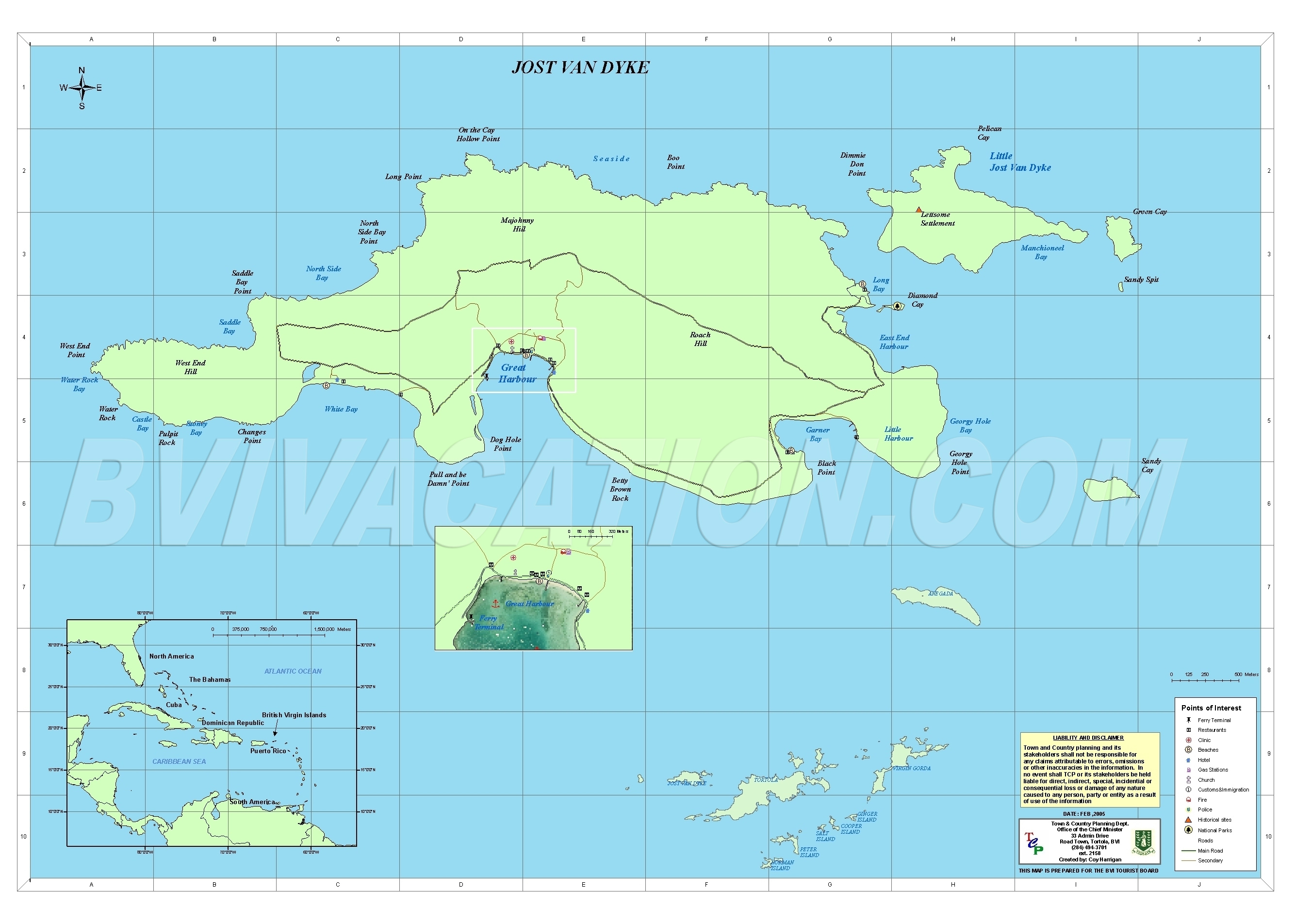
Jost Van Dyke is an island in the British Virgin Islands , about eight kilometers northwest of Tortola Island. With an area of just over eight square kilometers, it is the smallest of the four main islands.
geography
Like many of its neighboring islands, Jost Van Dyke is volcanic and hilly. The highest points on the island are Majohnny Hill at 321 m and Rouch Hill at 313 m . In the southern part of the island there are three anchor bays for sailors: White Bay, Great Harbor and Little Harbor. Jost Van Dyke is inhabited by around 300 people.
history
The island was named after the Dutch pirate Joost van Dyke . Its first settlers were Quakers who came to the island in the early 18th century to grow sugar cane.
Personalities
- William Thornton (1759–1828), architect and inventor
- John Coakley Lettsom (1744-1815), physician
Web links
Commons : Jost Van Dyke - collection of images, videos and audio files
- Jost Van Dyke. In: The British Virgin Islands. British Virgin Islands Tourist Board
- Maps - Jost Van Dyke. Detailed map of the island. In: British Virgin Islands Vacation. Vacation (BVI) Ltd., February 2005(English).
Individual evidence
- ^ Areas of the British Virgin Islands ( Memento of April 4, 2007 in the Internet Archive ); accessed on December 27, 2017.
- ↑ Judith Towle, Susan Zaluski (ed.): An Environmental Profile of the Iceland of Jost Van Dyke, British Virgin Islands, Including Little Jost Van Dyke, Sandy Cay, Green Cay and Sandy Spit . Jost Van Dykes Preservation Society (JVDPS) and Island Resources Foundation (IRF), Jost Van Dyke, BVI September 2009, p. 5 , Table 1: Known elevations for Profile islands (English, online [PDF; 5.1 MB ; accessed on December 27, 2017]).
- ^ Virgin Islands 2010 Population and Housing Census Report. (PDF; 2.52 MB) Executive Summary. Government of the Virgin Islands - Central Statistics Office, December 1, 2016, p. 1 , accessed December 27, 2017 .