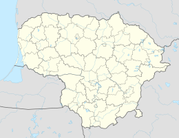
Juknaičiai (Šilutė)
| Juknaičiai | ||
|
||
| State : |
|
|
| District : | Klaipeda | |
| Rajong municipality : | Šilutė | |
| Office : | Juknaičiai | |
| Coordinates : | 55 ° 17 ′ N , 21 ° 35 ′ E | |
| Inhabitants (place) : | 892 (2011) | |
| Time zone : | EET (UTC + 2) | |
| Status: | Village | |
|
|
||
Juknaičiai ( German Jugnaten ) is a village in the Lithuanian district of Klaipėda . The place is the center of the district (Seniūnija) Juknaičiai and belongs to the Rajongemeinde Šilutė .
Geographical location
Juknaičiai is located in the southwest of Lithuania , in the former Memelland , about nine kilometers southwest of the municipality seat Šilutė . National road 141 , which connects Kaunas with Klaipėda , passes on the southwestern outskirts . Juknaičiai has a stop on the Sowetsk – Klaipėda railway line , on which passenger traffic has been suspended since 2011.
history
Since 1874 Jugnaten belonged (apparently) to the Wieszen district in the Heydekrug district .
Since its incorporation into the Lithuanian Soviet Socialist Republic , Juknaičiai has always been the seat of an administrative district; since 1945 a municipality (lit. valsčius), since 1950 a district (lit. apylinkė) and since 1995 an administrative district. As such, the place got a coat of arms in 2008.
Population development
| year | Residents |
|---|---|
| 1910 | 439 |
| 1959 | 231 |
| 1970 | 259 |
| 1979 | 715 |
| 1989 | 1206 |
| 2001 | 1106 |
| 2011 | 892 |
Infrastructure
There is a secondary school in Juknaičiai.
Attractions
In the former model collective farm there is still a recreation center designed in 1985 by architects S. Kalinka and P. Grecevičius. Inside the building there is a glass sculpture by Algimantas Stoškus , stained glass windows by Konstantinas Šatūnas and the fresco The Harvest Celebration by Angelina Banyté .
Sons and daughters of the place
- Horst Skodlerrak (January 18, 1920 - October 13, 2001), German painter
- Regina Eitmonė (born December 7, 1961), politician
Juknaičiai District
The Juknaičių seniūnija, which belongs to the Rajongemeinde Šilutė , has existed since 1995 . In the district there are 26 villages with a total of 2,466 inhabitants on an area of 160 km² (as of 2011). The county is divided since 2009 into the eleven subdistricts (lit. Seniūnaitija) Drunšilių seniūnaitija, Juknaičių I seniūnaitija, Juknaičių II seniūnaitija, Kanteriškių seniūnaitija, Leitgirių seniūnaitija, Menklaukių seniūnaitija, Paleičių seniūnaitija, Pašyšių seniūnaitija, Rumšų seniūnaitija, Šėrių seniūnaitija and Tarvydų seniūnaitija. The district includes:
| Place name | German name | Subdistrict | Place name | German name | Subdistrict | |
|---|---|---|---|---|---|---|
| Domaičiai | Heydeberg | Leitgiriai | Okslindžiai | Okslinden | Menklaukiai | |
| Drunšiliai | Drone tent | Drunšiliai | Paleičiai | Paleiten | Paleičiai | |
| Girininkai | Girreningken | Paleičiai | Pašyšiai | Paszieszen | Pašyšiai | |
| Gurgždžiai | Gurgsden | Drunšiliai | Piktaičiai | Picts | Rumšai | |
| Jakšteliai | Hunting spots | Kanteriškiai | Rumšai | Messing around | Rumšai | |
| Juknaičiai | Youth | Juknaičiai I u. II | Skieriai | Neusaß-Sköries | Menklaukiai | |
| Kanteriškiai | Kanterischken | Kanteriškiai | Šėriai | Neusaß-Scheer | Šėriai | |
| Klugonai | Wise guys | Juknaičiai I | Šilininkai | Great Schilleningken | Paleičiai | |
| Kūgeliai | Kugeleit | Šėriai | Šilviai | Schillwen | Drunšiliai | |
| Kūlynai | Kuhlins | Paleičiai | Tarvydai |
Minneiken u. Tarwieden |
Tarvydai | |
| Leitgiriai | Leader | Leitgiriai | Tautiškiai | Tautischken | Drunšiliai | |
| Menklaukiai | Mankuslauken | Menklaukiai | Vaitkaičiai | Woitkaten | Menklaukiai | |
| Naujininkai | Neusaß-Gritzas | Menklaukiai | Vyžiai | Wieszen | Juknaičiai I |
Web links
Individual evidence
- ↑ census data
- ↑ Frederic Chaubin: CCCP. Cosmic Communist Constructions Photographed . Taschen, ISBN 978-3-8365-6505-9 , pp. 228 ff .


