Julius Straube
Julius Straube (born April 12, 1832 in Berlin ; † October 24, 1913 there ) was a German cartographer and founder of the Geographical Institute and map publisher Julius Straube .
Life
Julius Straube was the son of the Berlin butcher Johann Gottlieb Straube and his wife Dorothea. At the age of 15 he began training in military cartography, shortly afterwards he was already involved as an engraver in the creation of Reymann's special map of Central Europe (his name is recorded on some Reymann map sheets).
From 1858 to 1886 he headed the map publisher named after him. His son Benno took over the business until 1913. After insolvency proceedings were opened against Benno Straube's assets in 1913, Julius Straube died just 6 days later on October 24, 1913.
Geographical Institute and map publisher Julius Straube
In 1858 Julius Straube founded the Geographical Institute and map publisher Julius Straube in Berlin . The publisher's first (now known) own work was the “Berliner-Omnibus Timetable” published in 1864. The business principle of the publishing house was, as this first plan already shows, the creation of thematic city maps of Berlin as commissioned work based on official sources.
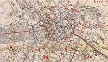
With the introduction of the Berlin postal districts in 1873, Julius Straube published a first postal plan in the same year, which documented the postal structure of Berlin. As before, with the plot numbers introduced around 1800 and their reception by the cartographer Jean Chrétien Selter, this series of plans is a significant example of how the city map cartographers reacted to certain administrative measures in the city. The postal delivery districts were an important orientation aid in Berlin well into the 20th century.
Probably the most remarkable work from the publishing house was the overview plan of Berlin, first published in 1885 on a scale of 1: 4000 on 44 individual sheets, which was updated regularly until 1910 - and at least partially until the 1930s. In 2003 the Berlin State Archives published a facsimile edition of this city map.
Between the Wilhelminian era and the First World War , Straubes Verlag was the market leader among the cartographic institutions in Berlin with a 36% market share. After 1900 at the latest, the publisher faced strong competition, mainly from Pharus-Verlag . The last plan from Straube Verlag appeared in 1946.
literature
- Andreas Matschenz: Geographical Institute and map publisher Julius Straube 1858–1969. A fragmentary Berlin publishing history . Supplement to the facsimile edition of Straube's overview plan 1: 4000, ed. from the Berlin State Archives. Edition Gauglitz Berlin, 2003, ISBN 3-933502-15-2 .
- Günther Schulz: City plans from Berlin 1652 to 1920 . Gebr. Mann, 1998, ISBN 3-7861-1973-2 .
Web links
- Julius Straube, cartographer . at friedenau-netzwerk.de Excerpt from: The artist cemetery in Friedenau
- Andreas Matschenz: On the cultural and historical development of the K 5 . Lecture. Landesarchiv Berlin - map department
Individual evidence
- ↑ Reymann's topographical special map of Central Europe, sheet Küstrin ( page no longer available , search in web archives ) Info: The link was automatically marked as defective. Please check the link according to the instructions and then remove this notice.
- ^ Jean Chrétien Selter: Floor plan of Berlin, 1811
- ^ Günther Schulz: City plans of Berlin 1652 to 1920 . Gebr. Mann, 1998, ISBN 3-7861-1973-2 , p. 82 .
- ↑ Andreas Matschenz: Chapter 7.1 Berlin city maps since 1920 . In: Catalog for the exhibition "Berlin-Brandenburg im Kartebild"
| personal data | |
|---|---|
| SURNAME | Straube, Julius |
| BRIEF DESCRIPTION | German cartographer and publisher |
| DATE OF BIRTH | April 12, 1832 |
| PLACE OF BIRTH | Berlin |
| DATE OF DEATH | October 24, 1913 |
| Place of death | Berlin |


