Cooling hole (dead mountains)
| Cooling hole
|
||
|---|---|---|
|
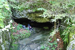
Portal of the cooling hole |
||
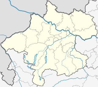
| Location: | Dead Mountains near Bad Ischl , Upper Austria | |
| Height : | 554 m above sea level A. | |
|
Geographic location: |
47 ° 41 ′ 51 ″ N , 13 ° 40 ′ 9 ″ E | |
|
|
||
| Cadastral number: | 1616/5 | |
| Geology: | Dachstein Limestone | |
| Overall length: | 1415 m | |
| Level difference: | +376 m | |
The cooling hole (cadastral number 1616/5) is an active water cave in the Dead Mountains in Bad Ischler municipality in Upper Austria. It is located in the Rettenbachtal at 554 m above sea level. A. directly on the road to the Rettenbachalm.
topology
From the flat, lens-shaped portal, the cave climbs uphill over a number of vertical steps. With a general north-easterly course, almost all parts are traversed by a brook that forms waterfalls and lakes. Overpasses have mountain milk deposits and damp clay. Also, sintered forms can be found. At normal water level, the stream flowing out of it disappears in the rubble almost 30 m in front of the entrance and flows underground to the Rettenbach. The entrance is only active in the event of severe flooding. Immediately behind it begins the spiral path , which rotates exactly 360 degrees and rises almost 10 m in the process. The further continuation is a passage that is low in places, but at the back, but also in the shape of a crevice, filled with water and leading into the waterfall hall . Here the cave stream falls from a height of 10 m and forms a pool of water. Driving beyond the area close to the entrance involves climbing and a lot of material.
Individual evidence
- ↑ Erhard Fritsch: The caves of the Rettenbach valley near Bad Ischl. 1st chapter. In: Apollo. 44, 1976, pp. 4-7 ( PDF (4.3 MB) on ZOBODAT ).

