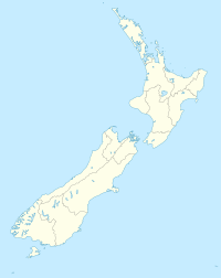
Kaikoura Canyon
| Kaikoura Canyon | |
|---|---|
| Location: | south of the Kaikoura Peninsula , on the east coast of the South Island of New Zealand |
| Coordinates: | 42 ° 37 'S, 173 ° 54' E |
| Length: | 30 to 40 km |
| Width: | up to 10 km |
| Depth: | up to 1400 m |
Coordinates: 42 ° 37 ′ 0 ″ S , 173 ° 54 ′ 0 ″ E
The Kaikoura Canyon is an undersea canyon off the north east coast of the South Island of New Zealand .
geography
The Kaikoura Canyon is located just 6 km south of the Kaikoura Peninsula and 0.5 km east of the Goose Bay . It extends with a width of up to 10 km, over 30 to 40 km in an easterly direction, until it merges into the Hikurangi Trench . Other sources give an area of 800 km 2 that the canyon is supposed to cover. South of the canyon , in the coastal area, joins the Conway Trough . Around 4 km from the continental shelf , the lake bed drops steeply to a depth of 1000 m, and further east even to 1400 m.
Ocean currents
The Subtropical Front (SF), a sub-Antarctic ocean current of the surface water, flows around the southern part of the South Island of New Zealand coming from the south of the Australian continent and moves northwards to the east of the South Island to turn east into the open Pacific Ocean above the depths of the Hikurangi Trench . This ocean current, which is called Southland Current in New Zealand , meets the subtropical East Cape Current, coming from the north , off Kaikoura and, when it meets off part of the east coast of New Zealand, leads to some turbulence, which is also caused by the depths of the Hikurangi Trench and Kaikoura Canyon are conditional. The Kaikoura Canyon is credited with breaking the southern flow. The currents south of the Kaikoura Peninsula in particular form a complex flow structure, as warm water and cold water mix with the addition of inland water from the rivers and constantly change in summer and winter times and due to topographical conditions.
geology
The continental shelf on the north east coast of the South Island has a 1 to 1.5 km thick layer that has formed over the past 24 million years. Underneath is an approximately 138 million year old layer of maritime sediments followed by a rock layer of greywacke that is up to 280 million years old . The Kaikoura Canyon is a deep cut into this continental shelf, which on the east coast of the South Island is usually between 20 and 100 km wide. Although no river carries its sediments into the canyon , it does take the sand and debris carried along by the northward current and forward them to the north into the lower-lying Hikurangi Trench . The sediments deposited on the steep slopes can, as on the mountain slopes, generated by earthquakes , slide deeper into the canyon and, depending on their size and extent, trigger a coastal tsunami . This tsunami can be very large and reach the coast with minimal warning, in the worst case without.
Flora and fauna
In 2006, scientists from the National Institute of Water and Atmospheric Research (NIWA) explored the canyon's deep sea for three days. The result was impressive. The scientists said the Kaikoura Canyon ecosystem is 10 to 100 times more productive than other comparable habitats . They found out that around 500 individuals per square meter could be found on the canyon floor , ten times more than was previously found anywhere else, the existing biomass even 100 times more. They stated the abundance of fish in the canyon at around 5000 fish per hectare , 10 times more than in the North Pacific.
The scientists also found large deposits of silt and mud on the edges of the canyon , which could trigger tsunamis in coastal regions in the event of a major seaquake or earthquake. They were able to provide around 150 evidence of landslides in the past.
literature
- Deirdre E. Hart, Islay D. Marsden, Malcolm Francis : The Natural History of Canterbury . Canterbury University Press , Christchurch 2008, ISBN 978-1-877257-57-5 , Chapter 20 - Costal systems , pp. 653–684 (English, online [PDF; 2.6 MB ; accessed on February 24, 2017]).
- MS Rattenbury, DB Townsend, MR Johnston : Geology of the Kaikoura Area . In: GNS Science (Ed.): Geological Map . tape 13 . Lower Hutt 2006, ISBN 0-478-09925-8 (English, online [PDF; 4.2 MB ; accessed on February 24, 2017]).
Web links
- Mysteries of the deep . In: Stuff - Kaikoura Star . Faifax Media, April 6, 2011,accessed February 25, 2017.
Individual evidence
- ↑ a b Hart, Marsden, Francis : The Natural History of Canterbury . 2008, Chapter 20 - Costal systems , p. 655 .
- ↑ a b c Mysteries of the deep . In: Stuff - Kaikoura Star . Faifax Media , April 6, 2011, accessed February 25, 2017 .
- ^ MS Rattenbury, DB Townsend, MR Johnston : Geology of the Kaikoura Area . 2006, p. 11 .
- ↑ Kaikoura Canyon - the hottest hotspot . National Institute of Water and Atmospheric Research (NIWA), February 24, 2011, accessed on February 25, 2017 .
- ↑ Hart, Marsden, Francis : The Natural History of Canterbury . 2008, Chapter 20 - Costal systems , p. 656-659 .
- ↑ Hart, Marsden, Francis : The Natural History of Canterbury . 2008, Chapter 20 - Costal systems , p. 653 .
- ^ MS Rattenbury, DB Townsend, MR Johnston : Geology of the Kaikoura Area . 2006, p. 47 .
- ^ MS Rattenbury, DB Townsend, MR Johnston : Geology of the Kaikoura Area . 2006, p. 7.59 .
