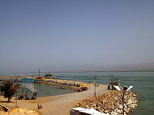
Kairakkum Reservoir
| Kairakkum Reservoir | |||||||||
|---|---|---|---|---|---|---|---|---|---|
| View of the Kairakkum reservoir | |||||||||
|
|||||||||
|
|
|||||||||
| Coordinates | 40 ° 17 ′ 0 ″ N , 70 ° 0 ′ 0 ″ E | ||||||||
| Data on the structure | |||||||||
| Construction time: | 1956-1958 | ||||||||
| Height of the barrier structure : | 32 m | ||||||||
| Crown length: | 1100 m | ||||||||
| Power plant output: | 126 MW | ||||||||
| Data on the reservoir | |||||||||
| Water surface | 430 km² | ||||||||
| Storage space | 4160 million m³ | ||||||||
The Kairakkum Reservoir is the largest reservoir in Tajikistan in terms of area . Other spellings are Kajrakkum , Kayrakkum or Kairakkumskoye . It is also called the "Tajik Sea".
Near the Tajik city of Khujand , the distance is about 15 km, the water of the Syr Darya is dammed in the Fergana Valley . The resulting reservoir is about 55 km long and up to 20 km wide. At full congestion it covers an area of 430 km², at high water up to 513 km². With a storage volume of 4.16 billion cubic meters, this results in an average depth of almost ten meters. Its maximum depth at the barrier structure is 25 m.
The barrier structure of the dam is a 32 m high and 1,100 m long dam made of bulk material. It was built in 1956 as part of the major Soviet irrigation projects. The Syrdarya is dammed up several times for irrigation purposes and for energy generation.
The lake is listed as an important bird area in the Ramsar List .
See also
- List of power plants in Tajikistan
- List of dams in the world (Tajikistan)
- List of the largest dams on earth
- List of the largest reservoirs on earth
- List of the largest hydroelectric plants in the world
Web links
- Development of Dams in the Russian Federation and other NIS Countries ( Memento from June 13, 2010 in the Internet Archive ) (PDF file; 711 kB)
Individual evidence
- ↑ Kairakkum (Kayrakkum) Hydroelectric Power Plant Tajikistan. Global Energy Observatory, accessed September 15, 2017 .
- ↑ Ahad Ahrorov: Ferghana Valley Water Resources Management Project. In: PDF. Ministry of Water Resource Management, Tajikistan, accessed May 2, 2016 .
- ^ The Ramsar List of Wetlands of International Importance (PDF)

