Berezina canal system
|
The Berezina canal system historically |
|||
|---|---|---|---|
|
Sketch of the Bersinska Canal System |
|||
| location |
|
||
| length | 161.5 km | ||
| Built | 1797-1805 | ||
| Expanded | 1810-1812, 1823-1836, and 1870-1880s | ||
| Shut down | Beginning of the 20th century | ||
| Covered in | In 1941 some locks were blown up; many stretches have silted up | ||
| Beginning | Serguch Canal near the village of Brody, Minskaya Woblasz , Belarus , branch of the Beresina (Bjaresina) | ||
| The End | The Ula flows into the Düna at Ula | ||
| Descent structures | 14th | ||
| Ports | Lepel, Ula | ||
| Used river | Beresina, Serguch, Beretschtscha, Essa, Ula | ||
| The Beresina canal system consists of man-made canals that connect natural and straightened watercourses | |||
| Serguchsky Canal | |||
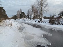
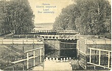
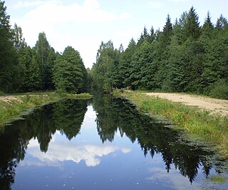
The Beresina canal system ( Belarusian Бярэзінская водная сістэма , Russian Березинская водная система ) connected the Black Sea with the Baltic Sea in the 19th century . For this purpose, the existing rivers were expanded to 161.5 kilometers and connected with canals. There were 14 locks and four weirs. The canal leads over the continental watershed (Baltic Sea / Black Sea), which is only 150 meters high here despite the great distances to the seas.
history
The first projects to the Dnieper with the Daugava ( Belarusian Заходняя Дзвіна ) combined, have been developed 1,701th There was considerable interest in the abundance of wood in the forests of the Minsk governorate .
The idea of the Beresina Canal came from the Polish nobleman Czaczky in 1794. The canal system was built between 1797 and 1805. The engineers were Johann Conrad Gerhard , his son Fjodor (Ferdinand) Gerhard, MI Freilang, Jan de Witte, François Sainte de Wollant. The system was reconstructed and expanded in 1810–1812, 1823–1836 and in the 1870–1880s.
Since the canal leads largely through wetlands, the expansion was very complex and technically demanding. The winding rivers made the traffic complicated. In some cases, the run was shortened and simplified by short connecting channels. The system was used by small boats and rafts. With the course through some lakes and through storage basins, attempts were made to keep the fairway at 1 meter depth. Traffic had to be stopped in dry periods. In winter it was not possible to operate the canal due to the ice.

This waterway made it possible to export logs, agricultural products and raw materials from the Governments of Mogilev and Minsk to the port of Riga . The traffic to the south was less pronounced. Until 1817 and from the 1880s onwards, shipping was carried out, mostly with tow barges . At the end of the 19th century, up to 50 million poods of cargo were being carried. The competition of the railroad led to the decline of the waterway at the beginning of the 20th century. Before 1941 it was used to transport timber, but during the Second World War the locks were blown up and parts of the canals fell into disrepair.
Currently, sections of the canals are becoming increasingly popular with tourists and an interesting area for water sports. Part of it leads through extensive nature reserves. The abundance of fish is remarkable for anglers.

See also
Web links
- ^ Description of all navigable and flowable canals dug or projected in the Russian Empire by Johann Christian Stuckenberg 1841, p. 40.
- ^ Department of Tourism, Environmental Education and Information Support
- Information about the channel (Russian), richly illustrated

