Cape Badur
|
Cape Badur Tanjung Badur |
||
 |
||
| Geographical location | ||
|
|
||
| Coordinates | 6 ° 29 ′ S , 105 ° 39 ′ E | |
| coast | Coast of java | |
| Waters | Sunda Street | |
 Tanjung Reading Hotel on Cape Badur before the 2018 tsunami |
||
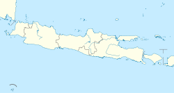
The Cape Badur ( Indonesian Tanjung Badur ) is a cape on the west coast of the island of Java . Together with Cape Lesung (Tanjung Lesung) to the east, it forms the northern tip of the Tanjungjaya peninsula in the northwest of the Panimbang district ( Pandeglang administrative district , Banten province ), which protrudes prominently into the Sunda Strait . The Pantai Tanjung Lesung tourist beach, named after Cape Lesung, is located on Cape Badur .
On December 22nd, 2018, Cape Badur was hit by a tsunami triggered by the Krakatau eruption and an underwater landslide. As a result, the tourist facilities were destroyed, and numerous people were killed or injured.
Individual evidence
- ^ Map of the Pandeglang administrative district
- ↑ Death toll in Indonesia tsunami soars past 220; rescuers search for missing. In: business-standard.com. December 23, 2018, accessed December 27, 2018 .
- ↑ Tsunami in Indonesia: The death toll rises to over 420 ( memento from December 24, 2018 in the Internet Archive ), nzz.ch from December 25, 2018
