Cape Westbrook
| Cape Westbrook | ||
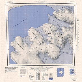
 Topographic map sheet of the Beethoven Peninsula (1: 250,000) with Cape Westbrook (bottom left) |
||
| Geographical location | ||
|
|
||
| Coordinates | 71 ° 50 ′ S , 75 ° 27 ′ W | |
| location | Alexander I Island ( West Antarctica ) | |
| coast | Beethoven Peninsula | |
| Waters | Ronne Entrance | |
| Waters 2 | Rameau Inlet | |
Cape Westbrook is a cape on the southwest coast of the West Antarctic Alexander I Island . It forms the southwestern end of the Beethoven peninsula .
The United States Geological Survey mapped the cape using aerial photographs taken by the US Ronne Antarctic Research Expedition (1947–1948), the United States Navy from 1967 to 1968, and Landsat images taken between 1972 and 1973. The Advisory Committee on Antarctic Names named it after Darrel E. Westbrook Jr. (* 1933), commander of the US Navy support units in Antarctica from June 1978 to June 1980.
Web links
- Cape Westbrook in the Geographic Names Information System of the United States Geological Survey (English)
- Cape Westbrook on geographic.org (English)
