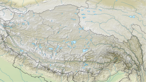
Karjiang
| Karjiang (South Peak) | ||
|---|---|---|
| height | 7221 m | |
| location | Tibet Autonomous Region ( China ) | |
| Mountains | Himalayas | |
| Dominance | 2.97 km → Kula Kangri (East Summit) | |
| Notch height | 895 m ↓ (6301 m) | |
| Coordinates | 28 ° 15 '27 " N , 90 ° 38' 48" E | |
|
|
||
| First ascent | unclimbed | |
The Karjiang is a mountain in the eastern Himalayas in the Tibet Autonomous Region .
It is located a few kilometers north of the border with Bhutan . 2.97 km south-southwest lies the eastern summit of Kula Kangri .
In addition to the 7221 m high south summit (also Karjiang I or Karjiang South ), the Karjiang also has other secondary peaks:
- Central summit (or Karjiang II ; formerly also known as the north summit , 7018 m , ⊙ )
- Taptol Kangri (or Karjiang III , 6824 m , ⊙ ), located in the northwest
- Kangmi Kangri ( 6412 m , ⊙ ), on the northeast spur of the Karjiang
Ascent history
The south summit has not yet been climbed.
In October 1986 a Japanese expedition broke off the ascent of the southern summit and decided to climb the central summit for the first time. Nobuhiro Shingo, Kenji Tomoda and Hiroshi Iwasaki reached the summit on October 14, 1986.
Taptol Kangri and Kangmi Kangri were first climbed by a Dutch expedition in October 2001. On October 19, 2001, Haroen Schijf, Pepijn Bink, Willem Horstmann and Rein-Jan Koolwijk climbed the Taptol Kangri over the north face. The Kangmi Kangri was first climbed on October 21, 2001 by Rudolf van Aken and Court Haegens.
Web links
- Karjiang on Peakbagger.com (English)
