Kataja
| Kataja | ||
|---|---|---|
| Waters | Gulf of Bothnia | |
| Geographical location | 65 ° 42 ′ 37 ″ N , 24 ° 9 ′ 0 ″ E | |
|
|
||
| surface | 71 ha | |
| Residents | uninhabited | |
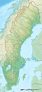
Kataja is a small uninhabited island (0.71 km²) in the Gulf of Bothnia , about 15 km from the mouth of the Torneälv at Haparanda and Tornio . The island is remarkable because it is divided between Sweden and Finland (see also: List of divided islands ). Two boundary stones and a marrow sheath mark the border, which here also represents the easternmost point of Sweden. Most of the island belongs to Sweden.
When the border between Sweden and Russia (which Finland had conquered from Sweden) was drawn in 1809 , it was still in the water between Kataja and the even smaller Finnish island of Inakari. However, the land uplift gradually created a connection between the two islands and thus a land border.

