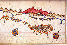
Kekova
| Kekova | ||
|---|---|---|
| Sunken city on Kekova | ||
| Waters | Mediterranean Sea | |
| Geographical location | 36 ° 11 ′ 0 ″ N , 29 ° 53 ′ 0 ″ E | |
|
|
||
| length | 7.5 km | |
| width | 1.7 km | |
| surface | 5.7 km² | |
| Highest elevation | 180 m | |
| Residents | uninhabited | |

Kekova is a small Turkish island on the Lycian coast near the city of Demre in the province of Antalya . The now uninhabited island is 5.7 km² and 7.5 km long; the highest point measures 180 meters.
On the north side of the island of Kekova are the partially sunken ruins of the ancient city of Dolichiste . In the 2nd century AD the place was destroyed by an earthquake, rebuilt during the Byzantine era , but later abandoned. Another quake - presumably in the 10th century - resulted in the ruins being largely under water today. In the north-west of the island there was a shipyard (Turkish: Tersane) in the ancient town of Xera with the possibility of launching.
The Kekova region also includes the towns of Üçagiz (ancient Teimiussa) on the nearby mainland , the ancient city of Aperlai and the small coastal town of Kaleköy , which was built on ancient Simena . From Üçagiz, the small port town on the mainland across from Kekova, boat trips to the sunken ruins start. Since 1990 the Kekova region with its around 260 km² has been under nature protection. Bathing, diving or snorkeling is prohibited in the sunken cities.
Individual evidence
- ↑ Kemal Kurt Eckert: A walk through Antalya and traveling in the area , Books on Demand, ISBN 978-3-8423-1951-6
- ^ History, culture, nature in Antalya and the western Mediterranean area , BAKA Development Agency of the Western Mediterranean Region 2012, ISBN 978-605-86397-2-0


