Kemp Rock
| Kemp Rock | ||
|---|---|---|
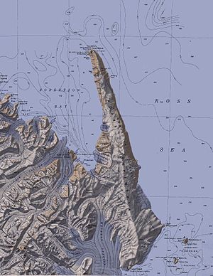
| Topographic map of the Adare Peninsula and Kemp Rock (bottom right) | ||
| Waters | Ross Sea | |
| Archipelago | Possession Islands | |
| Geographical location | 71 ° 58 ′ S , 171 ° 6 ′ E | |
|
|
||
The Kemp rock is a rock island in the Ross Sea off the Borchgrevink Coast of the East Antarctic Victoria Land . It is located between the islands of Foyn Island and Bull Island in the group of Possession Islands southeast of the Adare Peninsula .
The United States Geological Survey mapped them using their own measurements and aerial photographs of the United States Navy from 1960 to 1963. The Advisory Committee on Antarctic Names named them in 1969 after William R. Kemp, aerial photographer of the VX-6 flight squadron during a reconnaissance flight over the Possession Iceland on January 18, 1958.
Web links
- Kemp Rock in the Geographic Names Information System of the United States Geological Survey (English)
- Kemp Rock on geographic.org (English)

