Kenyir lake
| Kenyir lake | |||||
|---|---|---|---|---|---|
|
|||||
|
|
|||||
| Coordinates | 5 ° 0 ′ 0 ″ N , 102 ° 48 ′ 0 ″ E | ||||
| Data on the structure | |||||
| Construction time: | 1978-1987 | ||||
| Height of the barrier structure : | 155 m | ||||
| Building volume: | 16.91 million m³ | ||||
| Crown length: | 800 m | ||||
| Power plant output: | 400 MW | ||||
| Data on the reservoir | |||||
| Water surface | 260 to 380 km² | ||||
| Storage space | 23.6 million m³ | ||||
| Catchment area | 1260 km² | ||||
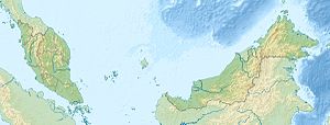
The Kenyir Lake (Tasik Kenyir) is a reservoir in Terengganu in northeast Malaysia , in which the Kenyir is dammed up to generate electricity from hydropower. It is 55 km from Kuala Terengganu . In 1988, the dam, made of rubble material, was inaugurated by Almarhum Sultan Mahmud Al-Muktafi Billah Shah. According to him, this is also hydropower plant Sultan Mahmud Power Station named. Tourism and fishing should also be promoted through the project.
The lake is one of the largest in Southeast Asia. The water level and thus the size of the water surface fluctuates over the course of the year. It is between about 260 and 380 km². The water level is highest in March and April, and usually lowest in August. There are 340 islands in the lake.
See also:


