Guys scan
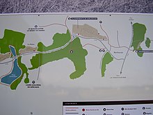
The stone row of Kerlescan belongs beside Le Menec , Kermario and Le Petit Menec to the "Carnac alignments". Kerlescan is located between Carnac and La Trinité-sur-Mer , in the Morbihan department in Brittany in France .
It is possible that the rows of stones from Kerlescan and Le Petit Menec once formed a unit that was cut up by the construction of villages and streets.
This ensemble has a square stone enclosure 78 × 74 m in the west . On its east side, 18 connecting stones have been preserved, from where the 13 rows of the Kerlescan alignment start , which extend over 880 m and comprise about 1149 stones. To the north is a special menhir a tumulus on. One kilometer to the south is the heavily restored Quadrilatère du Manio , an enclosure with the large menhir Géant du Manio .
During the German occupation of Brittany, a task force of German archaeologists carried out surveying and excavation work on the unique ensemble of rectangular menhir enclosure, rows of stones and the non-megalithic long hill. This work was carried out under the protection of the Wehrmacht. French prisoners of war, workers from the Todt organization , Breton schoolchildren and Wehrmacht volunteers were used as workers. The circumstances of this excavation are being processed in a project lasting several years.
Nearby is the Allée couverte from Kerlescan Nord .
Individual evidence
- ↑ Reena Perschke: Les mégalithes du Morbihan littoral sous l'occupation allemande (1940-1944). In: Bulletin et mémoires de la Société Polymathique du Morbihan. Volume 139, 2013, ISSN 0767-9882 , pp. 63-89.
literature
- Jacques Briard : Mégalithes de Bretagne . Ouest-France, Rennes 1987, ISBN 2-7373-0119-X .
Web links
Coordinates: 47 ° 36 '15.7 " N , 3 ° 2' 59.5" W.

