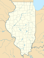
Kickapoo State Recreation Area
|
Kickapoo State Recreation Area
|
||
|
Middle Fork Vermilion River in the Kickapoo State Recreation Area |
||
| location | Vermilion County in Illinois (USA) | |
| surface | 11.50 km² | |
| Geographical location | 40 ° 8 ′ N , 87 ° 44 ′ W | |
|
|
||
| administration | Illinois Dept. of Natural Resources | |
Kickapoo State Recreation Area is a state park in Vermilion County in the US state of Illinois and is located northwest, in close proximity to Danville on Interstate 74 . The area of the local recreation area is 11.50 km². The area covers the final kilometers of the Middle Fork Vermilion River before it joins the Salt Fork Vermilion River to form the Vermilion River .
The name probably comes from a Kickapoo settlement that once lay between the branches of the Salt Fork Vermilion River and the Middle Fork Vermilion River. The Indian chief Kennekuk , after whom Kennekuk Cove County Park was named, is said to have lived there .
It is said that it was thanks to Clint C. Tilton , a local newspaper publisher and historian, that Kickapoo State Park in Vermilion County came into being.
Heron County Park is also in the immediate vicinity .
swell
- ↑ Stapp, Katherine; WI Bowman (1968). History Under Our Feet: The Story of Vermilion County, Illinois. Danville, Illinois: Interstate Printers and Publishers, Inc., p. 48.
Web links
- Photos from Kickapoo State Park
- Kickapoo at Stateparks.com
- Kickapoo State Recreation Area at the Department of Natural Resources

