Kirchberg (Kleinmuehlingen)
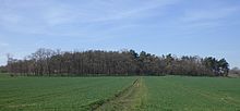
The Kirchberg , also known as Mühlberg , is an elevation in the district of Kleinmühlingen in Saxony-Anhalt .
The hill rises southeast of Kleinmühlingen to a height of 87.8 m. The hill is wooded on the east side. A little further east, the L 65 runs from Schönebeck (Elbe) to Calbe (Saale) . According to the land monument list of the state of Saxony-Anhalt, six burial mounds were built on the Kirchberg in prehistoric times . It may later also be used as a location for a castle . The Kleinmühlingen windmill is located near the summit . The mountain has been in use as the site of a mill since 1848. The area around the mill is partly used for parties and local events. The area, which is currently designated as a protected biotope , was declared a nature reserve by ordinance of January 25, 1926 . In the 1930s, a boulder called a " Hitler stone" was placed a few meters from the mill location and on July 30, 1996, it was smashed by lightning . The individual parts of the boulder are still on the summit today.
Individual evidence
- ↑ Short question and answer Olaf Meister (Bündnis 90 / Die Grünen), Prof. Dr. Claudia Dalbert (Bündnis 90 / Die Grünen), Ministry of Culture February 25, 2016 Printed matter 6/4829 (KA 6/9061) List of monuments Saxony-Anhalt. P. 82.
- ↑ Thomas Linßner, Blitz smashed the stone in 1996 , in: “ Schönebecker Volksstimme ” from May 10, 2013
Coordinates: 51 ° 57 ' N , 11 ° 45' E
