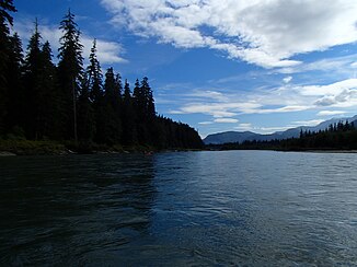
Kitimat River
| Kitimat River | ||
|
Kitimat River |
||
| Data | ||
| location | British Columbia (Canada) | |
| River system | Kitimat River | |
| Headwaters |
Kitimat Ranges 53 ° 58 ′ 22 ″ N , 128 ° 4 ′ 23 ″ W. |
|
| Source height | approx. 1300 m | |
| muzzle |
Kitimat Arm ( Douglas Channel ) Coordinates: 54 ° 0 ′ 39 ″ N , 128 ° 39 ′ 44 ″ W 54 ° 0 ′ 39 ″ N , 128 ° 39 ′ 44 ″ W. |
|
| Mouth height | 0 m | |
| Height difference | approx. 1300 m | |
| Bottom slope | approx. 14 ‰ | |
| length | approx. 90 km | |
| Catchment area | 2054 km² | |
| Discharge at gauge 08FF001 A Eo : 1990 km² Location: 10 km above the mouth |
MQ 1967/2014 Mq 1967/2014 |
131 m³ / s 65.8 l / (s km²) |
| Left tributaries | McKay Creek, Deer Creek | |
| Right tributaries | Chist Creek, Wedeene River, Little Wedeene River | |
| Small towns | Kitimat | |
|
View of Kitimat Airport (center) and Kitimat River (right) |
||
The Kitimat River is a river in the Regional District of Kitimat-Stikine in the western part of the Canadian province of British Columbia . The Kitimat River has a length of about 80 km. It drains an area of 2054 km².
The Kitimat River rises on the northern slope of Atna Peak in the Kitimat Ranges . From there it initially flows in a north-northwest direction, then makes an arc to the west and reaches the low-lying wide valley that connects Kitimat and Terrace . The British Columbia Highway 37 ( Terrace-Kitimat Highway ) crosses the river at this point and runs along the lower reaches of the Kitimat River in a southerly direction. About 6 km north of Kitimat is the 57 hectare Kitimat River Provincial Park on the east bank of the river . Shortly before Kitimat, the Hirsch Creek flows into the river from the left. The Kitimat River finally passes the small town of Kitimat and then flows into the Kitimat Arm , a side bay of the Douglas Channel . To the west of the estuary is an aluminum smelter from Rio Tinto Alcan .
The mean discharge is 131 m³ / s. The highest monthly outflows occur between May and July.
Web links
- Kitimat River . In: BC Geographical Names (English)
- Kitimat River Provincial Park

