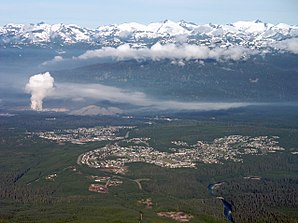
Kitimat
| Kitimat | ||
|---|---|---|
 Kitimat |
||
| Location in British Columbia | ||
|
|
||
| State : |
|
|
| Province : | British Columbia | |
| Regional District : | Regional District of Kitimat-Stikine | |
| Coordinates : | 54 ° 4 ′ N , 128 ° 38 ′ W | |
| Height : | 40 m | |
| Area : | 242.63 km² | |
| Residents : | 8335 (as of 2011) | |
| Population density : | 34.4 inhabitants / km² | |
| Time zone : | Pacific Time ( UTC − 8 ) | |
| Postal code : | V8C | |
| Climate diagram | ||||||||||||||||||||||||||||||||||||||||||||||||
|---|---|---|---|---|---|---|---|---|---|---|---|---|---|---|---|---|---|---|---|---|---|---|---|---|---|---|---|---|---|---|---|---|---|---|---|---|---|---|---|---|---|---|---|---|---|---|---|---|
| ||||||||||||||||||||||||||||||||||||||||||||||||
Kitimat is a coastal city in northwestern British Columbia in the Regional District of Kitimat-Stikine . The Kitimat Valley is part of one of the most famous urban districts in Northwest British Columbia . The community area covers 242.63 km².
The Kitimat River flows south of the community into the Kitimat Arm , a side bay of the Douglas Channel . The Kitimat Arm is also navigable for large ships.
history
The town was planned and built in the 1950s by the Aluminum Company of Canada (Alcan) mining company in connection with the construction of the Kenney Dam on the Nechako.
The granting of local self-government for the municipality took place on March 31, 1953 ( incorporated as District Municipality ).
Demographics
The census in 2011 showed a population of 8,335 inhabitants for the district municipality. The city's population has decreased by 7.3% compared to the 2006 census, while the population in the entire province of British Columbia rose by 7.0% in the opposite direction. This means that the population has continued to decline since 1991. The municipality lost more than 25% of the 11,305 inhabitants at that time.
economy
The average income of employees in Kitimat in 2006 was 33,931 C $, well above the average for the province of British Columbia, where the average in 2006 was only 24,867 C $.
Rio Tinto Alcan operates a plant in Kitimat . In 2013 the approximately 1200 employees at the plant produced 171,704 tons of aluminum.
traffic
The Highway 37 leading into a north-south direction through the congregation.
Kitimat Airport (Transport Canada Identifier: CBW2) is about 13 kilometers north of the community . The airfield only has a gravel runway 914 meters long.
The small town is also connected to the Canadian rail network. Canadian National Railway operates a station here.
Personalities
- Jamie MacDonald (* 1994), short tracker
- Rod Pelley (born 1984), ice hockey player
- Alison Redford (1965), politician and former Prime Minister of the Province of Alberta
- Eden Robinson (* 1968), writer
Web links
- District of Kitimat
- Kitimat ( English, French ) In: The Canadian Encyclopedia .
Individual evidence
- ^ Origin Notes and History. Kitimat. In: GeoBC . Retrieved October 1, 2012 .
- ↑ Kitimat Community Profile. Census 2011. In: Statistics Canada . September 7, 2012, accessed October 2, 2012 .
- ↑ Kitimat Community Facts. In: BCStats . Retrieved October 2, 2012 .
- ↑ Sustainable Development Report 2013. (PDF; 1.9 MB) In: Rio Tinto Alcan. Retrieved June 19, 2015 .
