Klintum (Foehr)
|
Klintum
municipality Oldsum
Coordinates: 54 ° 43 ′ 49 ″ N , 8 ° 27 ′ 22 ″ E
|
||
|---|---|---|
| Height : | 3 m | |
| Residents : | 48 (May 25 1987) | |
| Postal code : | 25938 | |
| Area code : | 04683 | |
|
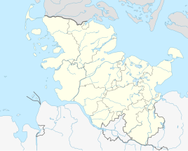
Location of Klintum in Schleswig-Holstein |
||
|
Friedrich von Warnstedt's Map of Föhr (1823)
|
||
Klintum (Frisian: Klantem, Danish Klintum ) is a district of the Oldsum municipality on the North Sea island of Föhr .
geography
Klintum lies between Oldsum in the west and Toftum in the east on the border of Geest and Marsch . The village was laid out as a row village in which several courtyards were merged into "cells". Klintum passes into the two neighboring towns without a settlement boundary.
history
The name Klintum refers to klint or klant , "cliff", and - um , "home". Almost all Föhrer villages have the suffix - um .
Already on Friedrich von Warnstedt's map from 1823, Oldsum, Klintum and Toftum appear as a contiguous row village with no recognizable settlement boundaries between the places.
From 1867 onwards, Klintum and Oldsum formed the Oldsum-Klintum community, which merged with Toftum in 1970 to form the Oldsum community.
As of the date of the census on May 25, 1987, the district had 48 inhabitants in 16 households. As early as 1889, 16 households were counted in the village of Klintum.
Economy and Transport
Main industries are tourism and agriculture. The national road 214, "Rundföhrstraße" runs south past Klintum; the place is connected via a county road.
Individual evidence
- ↑ Uwe Bonsen: Geography of Föhr. In: Margot and Nico Hansen: Föhr: History and shape of an island. Hansen & Hansen, Münsterdorf 1971, p. 28.
- ↑ Housing directory Schleswig-Holstein 1987 Statistisches Landesamt Schleswig-Holstein, Kiel 1992, p. 40.
- ↑ Christian Jensen: The North Frisian islands of Sylt, Föhr and Amrum and the Halligen formerly and now. Hamburg 1891, p. 398.

