Ko Kut
| Ko Kut | ||
|---|---|---|
| Ko Kut | ||
| Waters | Gulf of Thailand | |
| Geographical location | 11 ° 39 ′ N , 102 ° 34 ′ E | |
|
|
||
| length | 23 km | |
| width | 9 km | |
| surface | 113.5 km² | |
| Highest elevation | 315 m | |
| Residents | 2000 18 inhabitants / km² |
|
| main place | Ban Ao Salad | |
| Nam Tok Khlong Chao | ||
Ko Kut (other spellings: Koh Kuut, Ko Kood, Thai : เกาะ กูด ) is an island in the province ( Changwat ) Trat in the eastern region of central Thailand . Ko Kut belongs to the district ( Amphoe ) Ko Kut of the province Trat.
geography
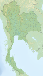
Ko Kut is located in the Gulf of Thailand on the east coast of Thailand near the border with Cambodia . A few kilometers north is the island of Ko Chang . The trip to the mainland takes about an hour by speedboat. With an area of 113.5 km², Ko Kut is a medium-sized island, wooded and slightly hilly (highest elevation 315 m), with a few fishing villages and coconut plantations.
The largest place is Ban Ao Salad in the northeast. There are two medium-sized waterfalls on the island, the larger “Nam Tok Khlong Chao” (Thai: น้ำตก คลอง เจ้า - Khlong Chao waterfall ) and a slightly smaller one in the north, the “Nam Tok Klong Yaiki” waterfall.
Demographics
Around 2,000 people live on the island, so Ko Kut is the district with the lowest population density in Thailand.
economy
The economic factors are fishing, coconut and rubber tree cultivation and growing tourism.
tourism
Since there is only a limited infrastructure here, it is not yet as crowded with tourists as the neighboring island of Ko Chang . There are some small resorts frequented by Thai tourists who prefer a quiet, family atmosphere, and a growing number of foreign tourists.
The underwater world attracts diving tourists. From time to time the island is also the destination of cruise tourists who are drawn here from the anchorage at Laem Chabang .
Individual evidence
- ↑ UNEP Islands (English)


