Ko Tao
| Ko Tao | ||
|---|---|---|
| Ko Tao, Mango Bay | ||
| Waters | Gulf of Thailand | |
| Archipelago | Mu Ko Samui | |
| Geographical location | 10 ° 5 '38 " N , 99 ° 50' 11" E | |
|
|
||
| length | 7.5 km | |
| width | 3.5 km | |
| surface | 21 km² | |
| Residents | 5000 238 inhabitants / km² |
|
| main place | Mae Hat | |
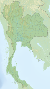
Ko Tao ( Thai : เกาะ เต่า ) is an island ( Thai : เกาะ - Ko ) in the Gulf of Thailand around 70 km east of the Isthmus of Kra and 45 km north of Ko Pha-ngan off the southeast coast of Thailand . The island belongs to the Surat Thani Province .
geography
Ko Tao is the third largest island of the Samui Archipelago ( Mu Ko Samui ), named after the island Ko Samui located about 60 km to the south , to which about 60 more islands belong, including Ko Pha-ngan , the around 40 islands of the Ang Thong National Park and the small island group of Nang Yuan just off the coast of Ko Tao .
The name Ko Tao means "turtle island" and comes from a time when the sea around the island was still inhabited by large numbers of sea turtles . In cooperation with the Thai Fisheries Department, turtles and mussels are being reared on the island again, which can later be released on the reefs. Another environmental protection project is the "Biorock Project 2008", where an artificial reef was created in front of the beach at Sairee.
On the small island group of Nang Yuan off the northwest coast of Ko Taos, there is a privately owned resort with a diving school. Ko Tao is 21 square kilometers.
history
Ko Tao was uninhabited for a long time and was only occasionally visited by fishermen to seek shelter from storms or to take in fresh fresh water.
On June 18, 1899, King Chulalongkorn (Rama V) visited the island and, like on the neighboring island of Ko Pha-ngan, left his monogram on a rock in Jor-Por-Ror Bay.
From 1933 Ko Tao was used as a prison island because of its relatively great distance from the mainland. Political prisoners in particular were sent here. It was only when Prime Minister Kuang Abhayawongse asked the king for an amnesty for the prisoners in 1947 that they were brought back to the mainland and the prison was closed. For a short time the island was uninhabited again.
In the same year the brothers Khun Ueam and Khun Oh crossed over from Ko Pha-ngan and settled in Sairi Bay ( อ่าว หาด ทราย รื , "Sairee", literally: Ri Bay). Their families followed suit and they started to cultivate the land. As everywhere in the region, besides fishing, coconut trees and growing vegetables were the most important agricultural livelihoods.
It was not until the mid-1980s that the first holiday guests joined the hitherto only residents. Young travelers, who had previously visited Samui, later Pha-ngan, “discovered” Ko Tao as an island that until then had been untouched by international tourism. And as before with the larger neighboring islands, the first visitors were soon followed by more. In particular, divers were attracted by the rich marine life in the area around the island.
The number of tourists has increased steadily since then and Ko Tao is now considered the most popular diving area in Southeast Asia for beginners . At the same time the tourist infrastructure grew, the tourist center is the west coast. In addition, the bays of Chalok Ban Kao ( อ่าว โฉลก บ้าน เก่า ) and Tanot ( อ่าว โตนด ) are particularly accessible. Around the island there is the often-terrain vehicles or boat taxis, actually Longtail -Fischerbooten, accessible bays a variety usually easier bungalows and cabins in pile construction. Especially in the largest and most easily accessible bays on the west coast, near the main town of Mae Hat ( อ่าว แม หาด , Mae Hat Bay ), where all the ferries heading for the island dock, and at the neighboring Sairee Bay, a number of Bungalow complexes and several hotels built. A large number of diving schools have also been founded to meet the needs of the guests who initially came mainly for diving .
Since the beginning of the 2000s, tourism has been the main source of income for the island's population, which has grown to around 4,000 people. The vast majority of guests are still backpackers . With the meanwhile faster boat connections to the mainland and the more touristically developed neighboring islands in the south, the number of guests from the rest of the tourist spectrum is also growing. The corresponding infrastructure such as restaurants, banks and shops can be found primarily in the main town of Mae Hat , in Chalok Ban Kao and Sairee . With the increase in wealthy tourists, as in the past on Samui and Pha-ngan, the older wooden bungalows are increasingly being replaced by buildings that are supposed to offer more comfort.
Impressions from Ko Tao
Web links
- Overview map of Ko Tao (names in English and Thai) [last accessed on November 17, 2013]


