Surat Thani Province
| Surat Thani | |
|---|---|
| สุราษฎร์ธานี | |

|
|
| statistics | |
| Capital: | Surat Thani |
| Telephone code: | 077 |
| Surface: |
12,891.5 km² 6. |
| Residents: |
994.221 (2009) 21. |
| Population density : | 77 E / km² 62. |
| ISO 3166-2 : | |
| Governor : | |
| map | |

Surat Thani ( Thai สุราษฎร์ธานี ) is a province ( Changwat ) in the southern region of Thailand . The capital of the province is also called Surat Thani .
geography
Surat Thani is the largest of the provinces in southern Thailand in terms of area. The province is about 680 kilometers south of the capital Bangkok . The land is flat and very fertile, rising to the west to a high plateau.
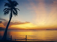
The main rivers are the Maenam Tapi and the Maenam Phum Duang, which flow into the Gulf of Thailand. The province also includes several of the most beautiful islands in the country, including Koh Samui , Ko Pha-ngan and Koh Tao as well as the around 40 islands of the Ang Thong Marine National Park .
| Adjacent provinces and areas: | |
|---|---|
| north | Chumphon and Ranong |
| east | Gulf of Thailand and Nakhon Si Thammarat |
| south | Nakhon Si Thammarat and Krabi |
| west | Phang-nga and Ranong |
climate
The climate in the province is tropical and, as is customary in southern Thailand, very rainy. The daytime temperatures vary between 29 and 35 ° C, the night temperatures between 20 and 24 ° C. There are an average of 116 rainy days. The water temperature on the coast is around 28 ° C all year round.
The maximum temperature in 2008 was 36.3 ° C, the lowest temperature was measured at 20.0 ° C. On 145 rainy days fell 1420.2 mm of precipitation in the same year .
Economy and Importance
The fertile land allows for a rich agriculture. In particular on the offshore islands of Ko Samui and increasingly also Ko Pha-ngan and Ko Tao , tourism developed into an essential economic factor alongside the management of coconut plantations and fishing.
Data
The "Gross Provincial Product" ( GDP ) of the province in 2008 was 131,475 million baht.
| Industry | 2006 | 2007 | 2008 | 2009 |
|---|---|---|---|---|
| Agriculture | 34.6 | 33.4 | 36.9 | |
| Industry | 16.5 | 16.5 | 14.6 | |
| Other | 48.9 | 50.1 | 48.5 |
All figures in%
The minimum wage in the province is 172 baht per day (around € 4).
By far the largest contributing industry to the province's economic output in 2011 was agriculture with 64.725 billion baht, followed by manufacturing with 29.778 billion baht, wholesale and retail with 21.989 billion baht and the hotel and restaurant industry with 12.578 billion baht.
Land use
The following land use is documented for the province:
- Forest area: 2,412,369 Rai (1,507.7 km²), 29.9% of the total area
- Agricultural area: 2,560,622 Rai (1,600.4 km²), 31.8% of the total area
- Unclassified area: 3,084,177 Rai (1,927.6 km²), 38.3% of the total area
traffic
Airports
- Surat Thani Airport ( IATA code : URT)
- Airport Ko Samui ( IATA code : USM)
history
Traces of Stone Age settlement can be found in the province. Chaiya was an important city in the sea area of Srivijaya (7th – 10th centuries), according to some historians even temporarily the capital of the empire.
See also: History of Thailand and corresponding entry in Surat Thani
Attractions
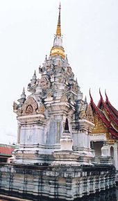
- Phra Borommathat Chaiya - with a beautiful 1200 year old chedi with an authentic Srivijaya architecture.
Symbols
The seal shows the chedi of Phra Borommathat Chaiya, which is said to have been built in the 9th century. The provincial flower is the Rafflesie Rafflesia kerrii (Thai: Bua Phut), the local tree is sound Kiam (Malay Resak) ( Cotylelobium melanoxylon ).
The motto of Surat Thani Province is:
- The city of a hundred islands
- The province of delicious fruits called rambutan ,
- The country with the best red eggs and great oysters ,
- In the city, the Buddhist principles are preached by the believers.
- (Thai: เมือง ร้อย เกาะ เงาะ อร่อย หอย ใหญ่ ไข่แดง แหล่ง ธรรมะ )
politics
Surat Thani Province is a stronghold of the Democratic Party . She has won all constituencies in every election since 1992. Two prominent politicians of the party come from Surat Thani: former chairman and deputy prime minister Banyat Bantadtan and Suthep Thaugsuban , who was general secretary of the party and also deputy prime minister. In the constitutional referendum in 2007, Surat Thani was one of the provinces with the highest approval rates (90.7%, compared to 8.0% no votes).
Well-known sons and daughters of the province
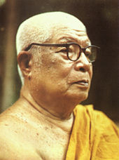
- Buddhadasa (1906–1993), Buddhist monk, philosopher, social activist and author
- Somdet Kiaw (1928–2013), Buddhist monk, 2005–2013 Acting Supreme Patriarch
- Banyat Bantadtan (* 1942), politician, former leader of the Democratic Party , former deputy prime minister and interior minister
- Yongyuth Wichaidit (* 1942), politician, former chairman of the Pheu Thai party , former deputy prime minister and interior minister
- Thida Thavornseth (* 1944), microbiologist and political activist
- Suthep Thaugsuban (* 1949), politician, former Secretary General of the Democratic Party, former Deputy Prime Minister, leader of the anti-government protest movement 2013/14
- Krisana Kraisintu (* 1952), pharmacist, AIDS researcher
- Jatuporn Prompan (* 1965), politician and activist, chairman of the National Democratic Alliance against dictatorship ("red shirts")
- Supinya Klangnarong (* 1973), media lawyer, former activist of the People's Alliance for Democracy ("yellow shirts")
- Worapoj Petchkoom (* 1981), boxing fighter
- Ekaphan Inthasen (* 1983), football player
- Onuma Sittirak (* 1986), volleyball player
- Krirkrit Thaweekarn (* 1990), football player
Administrative units
Provincial Administration
The province is divided into 19 districts ( Amphoe ). The districts are further subdivided into 131 parishes ( tambon ) and 1,028 villages ( muban ).
|
Local administration
A provincial administrative organization ( บริหาร ส่วน จังหวัด , อบ จ for short , Ongkan Borihan suan Changwat ; English Provincial Administrative Organization , PAO) exists for the entire area of the province .
There are two "big cities" ( เทศบาล นคร - Thesaban Nakhon ) in the province : Surat Thani ( เทศบาล นคร สุราษฎร์ธานี ) and Ko Samui ( เทศบาล นคร เกาะสมุย ). There are also three "cities" ( เทศบาล เมือง - Thesaban Mueang ):
- Don Sak ( เทศบาล เมือง ดอนสัก ),
- Tha Kham ( เทศบาล เมืองท่า ข้าม ) and
- Na San ( เทศบาล เมือง นา สาร ).
There are also 35 “small towns” ( เทศบาล ตำบล - Thesaban Tambon ) and 97 TAO.
literature
- Thailand in Figures 2011 . 13th edition. Alpha Research, Nonthaburi 2011, ISBN 978-616752603-4 .
Web links
- General map of the province (names in English and Thai) accessed on November 9, 2013
Individual evidence
- ↑ Thailand in Figures (2011)
- ^ Gross Provincial Product at Current Market Prices: Southern Provinces, National Economic and Social Development Board, 2011.
- ↑ Thailand in Figures (2011)
- ↑ Department of Local Administration : As of June 2014 (in Thai)
Coordinates: 9 ° 8 ' N , 99 ° 20' E


