
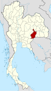
Buri Ram Province
| Buri Ram | |
|---|---|
| จังหวัด บุรีรัมย์ | |

|
|
| statistics | |
| Capital: | Buri Ram |
| Telephone code: | 044 |
| Surface: |
10,393.9 km² 17. |
| Residents: |
1,546,784 (2009) 6. |
| Population density : | 149 E / km² 28. |
| ISO 3166-2 : | |
| Governor : | Thongchai Lue-Adun |
| map | |
  |
|

Buri Ram ( Thai : จังหวัด บุรีรัมย์ , also referred to as Buriram ) is a province ( Changwat ) in the northeast region of Thailand , the so-called Isan . The capital of the province is also called Buri Ram .
geography
The province is located in the southern part of the Khorat Plateau on the border with Cambodia . There are numerous extinct volcanoes here . In the south rise the Phanom Malai Mountains , which form a natural border with Cambodia.
About 60% of the province's area is used for agriculture, 5% is forest area.
| Neighboring provinces and areas: | |
|---|---|
| north | Khon Kaen and Maha Sarakham |
| east | Surin |
| south | Sakaeo and national border with Cambodia |
| west | Nakhon Ratchasima |
Important cities
Important rivers
- Mae Nam Mun (Mun River)
- Mae Nam Chi (Chi River)
climate
The climate is tropical - monsoonal , with summer temperatures around 37 ° C and winter night temperatures of 8 ° C.
history
The area of Buri Ram was apparently an important province during the rule of the Khmer, the numerous very beautiful temple complexes still bear witness to this today. The Madharapura dynasty ruled here between the early 9th and 13th centuries . In the course of the displacement of the Khmer from what is now Thailand's territory in the 13th and 14th centuries, Buri Ram fell to the Kingdom of Ayutthaya.
Economy and Importance

The province of Buri Ram has a total of 951 wetlands with an area of 564.3 km², which are used more or less intensively for agriculture . The main source of income is rice cultivation . In addition, cattle and water buffalo are bred and jute , silk and tapioca are produced or grown.
In the course of the 1997 Asian crisis , the economy of Buri Ram province was also affected, but not all sectors equally. However, the effects were only noticeable in 1999 and 2000, during which the Gross Provincial Product (GPP) fell back below its 1995 level. After that, the GPP slowly recovers. See also the graphic opposite.
In 2011 the “Gross Provincial Product” ( gross domestic product ) was 65.976 billion Baht , while the GPP per capita in 2011 was 39.761 Baht.
Gross Provincial Product between 1995 and 2000
The gross provincial product before, during and after the 1997 Asian crisis (at current market prices).
| 1995 | 1996 | 1997 | 1998 | 1999 | 2000 |
|---|---|---|---|---|---|
| 23.067 billion baht | 25.518 billion baht | 25.965 billion baht | 27.145 billion baht | 28.569 billion baht | 25.111 billion baht |
Data from the Office of the National Economic and Social Development Board (NESDB):
Data
The table below shows the share of the economic sectors in the gross provincial product in percent:
| Industry | 2006 | 2007 | 2008 | 2011 |
|---|---|---|---|---|
| Agriculture | 22.0 | 23.2 | 21.9 | 26.55 |
| Industry | 12.6 | 12.2 | 13.4 | 22.5 |
| Other | 65.4 | 64.6 | 64.7 | 50.95 |
Data from the Office of the National Economic and Social Development Board (NESDB):
The industry that contributed most to the province's economic output in 2011 was agriculture with 17.390 billion baht, followed by manufacturing with 10.759 billion baht, education with 9.487 billion baht and wholesale and retail with 7.816 billion baht.
employment
In the province of Buri Ram, people still live and work mainly in the agricultural environment, in 1990 88.6% of all over 15-year-olds worked in the agricultural sector and 10 years later in 2000 it was just under 5 with 84% % fewer.
In 2000, the percentage of working life was as follows: 0.4% were employers, 33.5% were self-employed, 17.4% were employees and a full 48.7% were unpaid family workers.
Dams
Lam Nang Rong - Dam southwest of the provincial capital Buri Ram near the village of Ban Non Din Daeng, Amphoe Non Din Daeng: the 23 m high and 1,500 m long dam is used to irrigate the fields in the area.
traffic
Air traffic
Buriram Airport (Thai: ท่าอากาศยาน บุรีรัมย์ ; ICAO code: VTUO)
The airport is about 30 kilometers northeast of the city center of Buri Ram and can be reached by taxi or tuk-tuk .
Rail transport
The province of Buri Ram has several train stations, these are connected by the northeast line Bangkok - Ubon Ratchathani of the Thai State Railway ( State Railway of Thailand SRT):
| Train stations | ||
|---|---|---|
| Lam Plai Mat | Thamen Chai | Ban Salaeng Phan |
| Ban Nong Tat | Buri Ram | Ban Tako |
| Huai Council | Krasang | Nong Teng |
Furthermore, the northeast line connects Buri Ram with Nakhon Ratchasima in the west and Surin in the east.
Bus transport
There are several long-distance bus stations in Buri Ram Province
- Buri Ram Bus Terminal
- Nang Rong Bus Terminal
education
In 2006, Buri Ram Province had 874 schools with 13,064 teachers and 297,637 students. According to the NSO, only 42.4% went to school in 1990 and only 58.9% in 2000 of 6 to 24 year olds.
Universities
- Buriram Rajabhat University ( มหาวิทยาลัย ราชภัฎ บุรีรัมย์ )
- Ramkhamhaeng University - Regional Campus
Colleges
- Buriram Polytechnic College
- Buriram Agriculture and Technology College
- Buriram Technical College
- Buriram Agriculture College
- Satuek Industrial and Community Education College
- Nangrong Industrial and Community Education College
health

The province has 26 hospitals with 163 doctors, 1,137 nurses, 1,745 hospital beds, plus 42 dentists. (As of 2006)
Health facilities
- Buri Ram Central Hospital
- Buri Ram Private Hospital
- Nang Rong Hospital
- Dr. Surachet Hospital
- Satuek Hospital
population
Demographics
In 1990 the province of Buri Ram had 1,357,100 million inhabitants, ten years later there were 1,493,400 million inhabitants, with an average age of 27.3 years. The 1.4 million inhabitants were divided into 351,500 households in 2000 with a household size of 4.2 people on average, 5.3% of the households were single households. In 2000 about 14% of the people lived in urban areas, the largest proportion lived in Buri Ram, Nangrong and Lam Plai Mat.
Around 94% of Buri Ram households owned their own home in 2000, 89.7% had their own television, but only 38.7% cooked on gas or electric stoves. The sanitary connection and a (drinking) water connection were available in around 93% of the households.
The population distribution according to age groups is largely homogeneous in the classes from 0 to 35 years with a proportion of 8.5 & up to 9.1% depending on the further subdivided age group, this is different in the higher age groups, the proportion of 50 to 54 Year-olds is only 4.8% and that of the 70 to 74-year-olds is only 1.6% of the total population of Buri Ram Province. The age groups are each divided into 5 annual cycles. The breakdown by gender is also largely homogeneous; in 2000, 744,910 men and 748,449 women lived in the province. This can be reflected on both cities and rural areas. There are also no significant deviations with regard to the various districts.
Ethnicities and languages
Buri Ram Province is home to a number of different ethnic groups: Northern Khmer , Lao , Khorat-Thai, and Kuy (Suay). Accordingly, there are different languages and dialects: Phasa Isan (Lao), Khmer , Thai with Khorater dialect, Kuy. An estimated 50% of the provincial population are ethnic Khmer or their descendants. However, 99.8% are Thai citizens. According to official statistics, 27.6% of the population in Buri Ram speak Khmer or the related Kuy as their first language.
Attractions


- Prasat Hin Khao Phanom Rung ( ปราสาท หิน พนม รุ้ง ) - huge and very beautiful rock temple from the 12th century on a 400 m high extinct volcanic cone with a wonderful view of the flat landscape as far as Cambodia; the facility is known as "Angkor Wat's little brother". A temple festival takes place every April
- Prasat Hin Mueang Tam ( ปราสาท เมือง ต่ำ ) - located not far from Phanom Rung, dates back to the 11th century and has lintels carved in Khmer style and a laterite wall
- Khao Kradong ( วนอุทยาน เขา กระโดง ) - large Buddha image on a mountain, approx. 15 km outside the provincial capital
- Tao Sawai / Tao Nai Chian - Kilns from the 9th to 12th centuries in an old Khmer settlement (in Amphoe Ban Kruat)
- Prang Ku Suan Daeng ( ปรางค์กู่ สวน แตง ) - in Amphoe Phutthaisong, 3 Khmer prangs made of brick and mortar with intricately carved doors depicting episodes from Ramakien
- Pet Thong Grotto in Pakham County
- Phra Mahathat Srithamenchai in Lam Plai Mat County, a replica of Prathat Phanom
- Nature conservation and national parks :
- Phu Khao Fai Kradong Forest Park
- Dong Yai Wildlife Sanctuary
- National Park Ta Phraya (Thai: อุทยานแห่งชาติ ตาพระยา ) - together with Sa Kaeo , area 594 km²
Sports
The football club Buriram United has been one of the most successful clubs in Thailand since 2008. He has since won the national championship four times.
Symbols
The seal of the province shows the famous sandstone temple Phanom Rung, which bears a Hindu shrine of Shiva followers from the 9th to 12th centuries. The shrine was no longer in use after the subjugation of the Khmer by the Kingdom of Ayutthaya and was later opened as a historical park.
The local flower is the Yellow Cotton Tree ( Cochlospermum regium ) in Fai Kham or Supanika, Thailand, from the genus of the snail seed trees and the local tree is the rose cassia ( Cassia grandis ).
The motto of Buri Ram Province is:
- The city with ancient castles
- Beautiful Thai silk is woven by the people
- In the country there are volcanoes ,
- Rich in different cultures all around.
Administrative units
The province of Buri Ram is divided into 23 amphoe ('districts' or 'counties'). These are further subdivided into 188 tambon ('subdistricts' or 'municipalities') and 2,546 muban ('villages').
|

Local administration
A provincial administrative organization ( Thai องค์การ บริหาร ส่วน จังหวัด , short อบ จ. , Ongkan Borihan suan Changwat ; English Provincial Administrative Organization , PAO) exists for the entire area of the province . Its chairman is Karuna Chidchob, the wife of Newin Chidchob .
In the area of the province there are also 62 thesaban ('municipalities') - including three "cities" and 59 "small towns" - and 146 tambon administrative organizations.
literature
- Charles Higham : Encyclopedia of Ancient Asian Civilizations . New York: Facts on Files 2004.
- Thailand in Figures . 13. A. Nonthaburi: Alpha Research 2011. ISBN 9786167526034 .
Web links
- Buri Ram Province website (in Thai)
- German information about Buri Ram - Website of the Tourism Authority of Thailand (TAT)
- Overview map of the province (names in English and Thai) [last accessed on November 12, 2013]
- Information about Ta Phraya National Park (in English)
Individual evidence
- ↑ a b Official Paper Buriram Province (Thai; MS Word ; 1.9 MB)
- ^ Higham (2004), p. 263.
- ↑ Edmund JV Oh, Blake D. Ratner, Simon Bush, Komathi Kolandai and Terence Y. Too (eds.): Wetlands Governance in the Mekong Region: country reports on the legal-institutional framework and economic valuation of aquatic resources . 2005. (PDF; 4.7 MB)
- ↑ a b c d e Gross Regional and Provincial Product 1995-2011: Complete data as zip. ( Memento of the original from November 13, 2013 in the Internet Archive ) Info: The archive link was automatically inserted and not yet checked. Please check the original and archive link according to the instructions and then remove this notice.
- ^ Gross Provincial Product at Current Market Prices: Northeastern Provinces, National Economic and Social Development Board, 2011.
- ↑ a b c d e f g h i NSO: Key indicators of the population and housholds (English)
- ^ Information on the Royal Irrigation Department dam. Archived from the original on July 16, 2011 ; accessed on November 27, 2015 .
- ↑ a b c Chatpramon Pootichan (2009): Poverty and income inequality amond agricultural households in Buriram Provinces ( page no longer available , search in web archives ) Info: The link was automatically marked as defective. Please check the link according to the instructions and then remove this notice. (Dissertation, English)
- ^ Rajabhat University website
- ↑ Ramkhamhaeng University website (in Thai) ( Memento from November 12, 2013 in the Internet Archive )
- ↑ Rüangdet Phankhüankhan: Phasa thin trakun thai. Mahidol University, Bangkok 1988, p. 219. Quoted from Volker Grabowsky : The Isan up to Its Integration in the Siamese State. In: Regions and National Integration in Thailand, 1892-1992. Harrassowitz Verlag, Wiesbaden 1995, p. 108, fn. 5.
- ↑ Official Page Buriram (Thai)
- ↑ Official Paper Buriram Province (Thai; MS Word ; 1.9 MB)
- ↑ website of BPAO chairman of BPAO
North : Chiang Mai | Chiang Rai | Kamphaeng Phet | Lampang | Lamphun | Mae Hong Son | Nakhon Sawan | Nan | Phayao | Phetchabun | Phichit | Phitsanulok | Phrae | Sukhothai | Tak | Uthai Thani | Uttaradit
Northeast : Amnat Charoen | Bueng Kan | Buri Ram | Chaiyaphum | Kalasin | Khon Kaen | Loei | Maha Sarakham | Mukdahan | Nakhon Phanom | Nakhon Ratchasima | Nong Bua Lam Phu | Nong Khai | Roi Et | Sakon Nakhon | Si Sa Ket | Surin | Ubon Ratchathani | Udon Thani | Yasothon
Central : Ang Thong | Ayutthaya | Bangkok | Chachoengsao | Chai Nat | Chanthaburi | Chon Buri | Kanchanaburi | Lop Buri | Nakhon Nayok | Nakhon Pathom | Nonthaburi | Pathum Thani | Phetchaburi | Prachin Buri | Prachuap Khiri Khan | Ratchaburi | Rayong | Sa Kaeo | Samut Prakan | Samut Sakhon | Samut Songkhram | Saraburi | Sing Buri | Suphan Buri | Stepped
South : Chumphon | Krabi | Nakhon Si Thammarat | Narathiwat | Pattani | Phang-nga | Phatthalung | Phuket | Ranong | Satun | Songkhla | Surat Thani | Trang | Yala
Coordinates: 15 ° 0 ' N , 103 ° 6' E