
Phrae (province)
| Phrae | |
|---|---|
| แพร่ | |

|
|
| statistics | |
| Capital: | Phrae |
| Telephone code: | 054 |
| Surface: |
6,538.6 km² 32. |
| Residents: |
462.090 (2009) 58. |
| Population density : | 71 E / km² 59. |
| ISO 3166-2 : | |
| Governor : | |
| map | |
  |
|
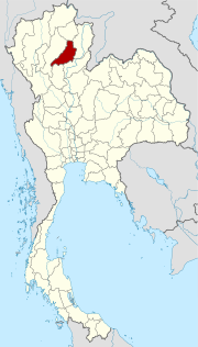
Phrae ( Thai แพร่ [ pʰrɛ̂ː ]) is a province ( Changwat ) in the northern region of Thailand . The capital of Phrae Province is also called Phrae .
geography
The province lies in the valley of the Mae Nam Yom (Yom River), one of the tributaries of the Mae Nam Nan (Nan River), which in turn feeds the Mae Nam Chao Phraya . The topography is shaped by the eastern foothills of the Phi Pan Nam Mountains , which here mainly consist of sharp-edged sandstone formations.
| Neighboring provinces: | |
|---|---|
| north | Phayao |
| east | Nan |
| south | Uttaradit and Sukhothai |
| west | Lampang |
Important rivers
National parks
- Mae Yom National Park ( อุทยานแห่งชาติ แม่ ยม )
- Doi Pha Klong National Park ( อุทยานแห่งชาติ ดอย ผา กลอง )
climate
The climate is tropical - monsoonal . The maximum temperature in 2008 was 40.6 ° C, the lowest temperature was measured at 9.2 ° C. In the same year, there was 1,168.5 mm of precipitation on 125 rainy days .
Economy and Importance
In 2009, the "Gross Provincial Product" (was GDP ) of the province of 23,375 million baht . The minimum wage in the province is 227 baht per day (around € 5; as of April 1, 2012).
Data
The table below shows the share of the economic sectors in the gross provincial product in percent:
| Industry | 2006 | 2007 | 2008 | 2009 |
|---|---|---|---|---|
| Agriculture | 16.8 | 18.2 | 21.3 | 20.9 |
| Mining, open pit mining | 0.6 | 0.8 | 0.4 | 0.6 |
| Industry | 18.4 | 17.5 | 18.0 | 16.8 |
| Other | 64.2 | 63.5 | 60.3 | 61.7 |
Land use
The following land use is documented for the province:
- Forest area: 2,572,262 Rai (4115.6 km²), 62.9% of the total area
- Agricultural area: 661,951 rai (1059.1 km²), 16.2% of the total area
- Unclassified area: 852,411 rai (1,363.9 km²), 20.9% of the total area
Products
In the province of Phrae, several products with five stars, such as hand-woven silk and cotton fabrics, are manufactured as part of the OTOP ( One Tambon One Product ) initiative .
Educational institutions
Universities
- Phrae Campus Maesai of Maecho University
history
The area around Phrae was already part of the Mon kingdom of Hariphunchai ( Lamphun ) when it came to Lan Na in 1443 under Tilokarat together with large parts of the province of Nan .


Attractions
- Wat Phra That Cho Hae ( วัด พระ ธาตุ ช่อ แฮ ) - the most important Buddhist temple ( Wat ) in the province from the Sukhothai period . In its 33-meter-high chedi , which is clad with copper plates, there is said to be a relic of the Buddha.
- Wat Phra That Suthon Mongkhon Khiri ( วัด พระ ธาตุ สุ โทน มงคล คีรี ) - in Den Chai District with an impressive Chedi in a mixed Lan Na / Burma style and with many sculptures decorated ubosot .
- Phae Mueang Phi ( วนอุทยาน แพะ เมือง ผี , Ghost Town Gorge ) is also known as the Grand Canyon of Thailand due to its rock formations. It is only about 18 kilometers from the provincial capital.
coat of arms
According to legend, the two provinces of Phrae and Nan were ruled by two brothers. When it came to dividing up the territory, they met in the mountains. One rode on a horse, the other on an ox, to the agreed meeting point. That is why Phrae has a horse in his coat of arms and Nan a buffalo.
In addition, the chedi of Wat Phra That Cho Hae can be seen on horseback, which can be visited about nine kilometers southeast of the provincial capital.
The local tree is the Chikrassy ( Chukrasia velutina , ชื่อ วิทยาศาสตร์ , also Burmese almond wood or Yimma), which is used as timber.
The motto of Phrae Province is:
Teak and mohom, the blue dyed fabric, are the glory of the city,
The land of tale "Phra Lo" is in its name,
The city of amiable people and the glamorous temple of Phra That Cho Hae,
Phae Mueang Phi is an attractive landscape here.
(in Thai: หม้อห้อม ไม้ สัก ถิ่น รัก พระ ล อ ช่อ แฮ ศรี เมือง ลือ เลื่อง แพะ เมือง เมือง ผี คน แพร่ นี้ ใจ งาม )
Others
- The romantic story Lilit Phra Lo ( ลิลิต พระ ล อ - "The story of Prince Lo") is the first example of Thai entertainment literature from the time of King Narai . The story of Prince Lo takes place in the province of Phrae and was written in a meter, Lilit ( ลิลิต ), that mixes verse with chanting prose.
Administrative units
Provincial Administration
The province is divided into 8 districts ( Amphoe ) . The counties are further subdivided into 78 communes ( tambon ) and 645 villages ( muban ) .
|

Local administration
A provincial administrative organization ( บริหาร ส่วน จังหวัด , อบ จ for short , Ongkan Borihan suan Changwat ; English Provincial Administrative Organization , PAO) exists for the entire area of the province .
There is one city ( เทศบาล เมือง - Thesaban Mueang ) in the province : Phrae ( เทศบาล เมือง แพร่ ). There are also 16 small towns ( เทศบาล ตำบล - Thesaban Tambon ).
literature
- Thailand in Figures, Vol.II: Region and Province . 16th edition 2012-2013, Alpha Research Co., Nonthaburi (Thailand) 2012, ISBN 978-616-7256-12-6
Web links
- Provincial Administration website (in Thai)
- Overview map of the province (names in Thai and English) accessed on November 11, 2013
Individual evidence
- ↑ a b c Thailand in Figures (2013), p. 265
- ↑ "Industry" includes: Manufacturing; Electricity, gas and water supply; Construction
- ^ "Others" include: Wholesale and retail trade; Hotels and restaurants; Transport, storage and communication; Real estate; Education; Health and social work, ...
- ↑ OTOP examples ( Memento of the original from April 13, 2014 in the Internet Archive ) Info: The archive link was inserted automatically and has not yet been checked. Please check the original and archive link according to the instructions and then remove this notice. on the website of the provincial administration (in Thai)
- ↑ Tin Chok Woven Cloth (in English)
- ↑ Department of Provincial Administration : As of 2012 (in Thai)
North : Chiang Mai | Chiang Rai | Kamphaeng Phet | Lampang | Lamphun | Mae Hong Son | Nakhon Sawan | Nan | Phayao | Phetchabun | Phichit | Phitsanulok | Phrae | Sukhothai | Tak | Uthai Thani | Uttaradit
Northeast : Amnat Charoen | Bueng Kan | Buri Ram | Chaiyaphum | Kalasin | Khon Kaen | Loei | Maha Sarakham | Mukdahan | Nakhon Phanom | Nakhon Ratchasima | Nong Bua Lam Phu | Nong Khai | Roi Et | Sakon Nakhon | Si Sa Ket | Surin | Ubon Ratchathani | Udon Thani | Yasothon
Central : Ang Thong | Ayutthaya | Bangkok | Chachoengsao | Chai Nat | Chanthaburi | Chon Buri | Kanchanaburi | Lop Buri | Nakhon Nayok | Nakhon Pathom | Nonthaburi | Pathum Thani | Phetchaburi | Prachin Buri | Prachuap Khiri Khan | Ratchaburi | Rayong | Sa Kaeo | Samut Prakan | Samut Sakhon | Samut Songkhram | Saraburi | Sing Buri | Suphan Buri | Stepped
South : Chumphon | Krabi | Nakhon Si Thammarat | Narathiwat | Pattani | Phang-nga | Phatthalung | Phuket | Ranong | Satun | Songkhla | Surat Thani | Trang | Yala
Coordinates: 18 ° 9 ′ N , 100 ° 8 ′ E