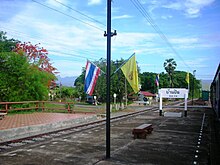
Amphoe Long
|
Long ลอง |
|
|---|---|
| Province: | Phrae |
| Surface: | 1,447.3 km² |
| Residents: | 56,029 (2012) |
| Population density : | 40.0 U / km² |
| ZIP : | 54150 |
| Geocode : | 5403 |
| map | |

|
|
Amphoe Long ( Thai อำเภอ ลอง , pronunciation: ʔāmpʰɤ̄ː lɔ̄ːŋ ) is a district ( Amphoe - administrative district) in the west of the Phrae Province in northern Thailand .
geography
Neighboring districts (clockwise from northeast): Song Amphoe , Nong Muang Khai , Mueang Phrae , Sung Men , Den Chai and Wang Chin of Phrae Province, and Mae Tha and Mae Mo of Lampang Province .
Doi Pha Klong National Park is located in Long County.
administration
Provincial Administration
The district is divided into nine communes ( tambon ) , which are further subdivided into 93 villages ( muban ) .
| No. | Surname | Thai | Muban | Pop. |
|---|---|---|---|---|
| 1. | Huai O | ห้วย อ้อ | 18th | 12,261 |
| 2. | Ban pin | บ้าน ปิ น | 13 | 7,792 |
| 3. | Ta Pha Mok | ต้า ผา ม อก | 8th | 4,713 |
| 4th | Wiang Ta | เวียง ต้า | 10 | 6,612 |
| 5. | Pak Kang | ปากกา ง | 9 | 4,203 |
| 6th | Hua Thung | หัว ทุ่ง | 9 | 5,861 |
| 7th | Thung Laeng | ทุ่ง แล้ง | 12 | 7,297 |
| 8th. | Bo Lek Long | บ่อ เหล็ก ลอง | 9 | 4,198 |
| 9. | Mae Pan | แม่ ปาน | 5 | 3,092 |
Local administration
There are six small towns ( Thesaban Tambon ) in the district:
- Ban Pin (Thai: เทศบาล ตำบล บ้าน ปิ น ) consists of parts of the Tambon Ban Pin,
- Huai O (Thai: เทศบาล ตำบล ห้วย อ้อ ) also consists of parts of the Tambon Huai O,
- Mae Pan (Thai: เทศบาล ตำบล แม่ ปาน ) consists of the entire Tambon Mae Pan,
- Mae Lan Na (Thai: เทศบาล ตำบล แม่ ลาน นา ) also consists of parts of the Tambon Huai O,
- Wiang Ta (Thai: เทศบาล ตำบล เวียง ต้า ) consists of the entire tambon Wiang Ta,
- Pak Kang (Thai: เทศบาล ตำบล ปากกา ง ) consists of the entire Tambon Pak Kang.
There are also five “Tambon Administrative Organizations” (TAO, องค์การ บริหาร ส่วน ตำบล - Administrative Organizations) for the tambon in the district that do not belong to any city.
Individual evidence
- ↑ Population statistics 2012 . Department of Provincial Administration. Retrieved April 8, 2014.
Web links
- More information about Amphoe Long from amphoe.com (in Thai)
- Official website of Doi Pha Klong National Park (in English)
Coordinates: 18 ° 5 ' N , 99 ° 50' E

