
Chai Nat (Province)
| Chai Nat | |
|---|---|
| ชัยนาท | |

|
|
| statistics | |
| Capital: | Chai Nat |
| Telephone code: | 056 |
| Surface: |
2,469.7 km² 64. |
| Residents: |
335.420 (2009) 66. |
| Population density : | 136 E / km² 26. |
| ISO 3166-2 : | |
| Governor : | |
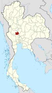
| map | |
  |
|
Chai Nat (also reproduced as Chainat ; Thai : ชัยนาท , pronunciation: [t͡ɕʰaj nâːt] ; roughly translated: "Place of Victory") is a province ( Changwat ) in the central region of Thailand .
geography
Chai Nat is located about 180 kilometers north of Bangkok in the central plain of the Mae Nam Chao Phraya ( Chao Phraya River ). Most of the land is slightly higher than the neighboring provinces and is designated as used for agriculture.
In the south is Thailand's first completed dam , the Chao Phraya Dam , formerly known as the Chai Nat Dam. The dam serves both to control the water in the agricultural area and to control the annual flooding . The Chao Phraya Dam was inaugurated in 1957.
| Bordering provinces: | |
|---|---|
| north | Nakhon Sawan |
| east | Sing Buri |
| south | Suphan Buri |
| west | Uthai Thani |
Other important cities
climate
The climate is tropical - monsoonal .
population
Mainly Thais live in Chai Nat . In addition, there are also descendants of the Lao Khrang , the Lao Khrang , who were abducted by Siamese from Laos , the total number of which in Thailand is 53,000.
Economy and Importance
Despite its relative proximity to Bangkok, Chai Nat is not influenced by tourism . The main source of income here is agriculture , in addition to rice cultivation, also the pomelo fruit.
The "Gross Provincial Product" ( GDP ) of the province in 2008 was 32,575 million Baht . The average income per household in 2008 was 13,995 baht per month.
Land use
According to Thailand in Figures (2011):
| Art | size | percent proportion of |
|---|---|---|
| Woodland | 47890 Rai | 3.1% |
| Agricultural land | 1,191,649 Rai | 77.2% |
| Unclassified country | 304,052 Rai | 19.7% |
Dams
- Chao Phraya Dam - inaugurated in 1957, about 8 km south of the provincial capital
history
King Nakarintharathirat of Ayutthaya sent his third son, Prince Chao Sam Phraya, to rule the city in 1419. Although he was the youngest son of his father, Sam Phraya was named the 7th King of Ayutthaya in 1424 as Borommarachathirat II . He had Chai Nat expanded into an important troop base that was supposed to fend off the increasingly frequent and growing attacks by the Burmese against Ayutthaya. They were also beaten back very often before Ayutthaya was completely destroyed in 1767.
From Chai Nat, King Taksin rolled up the Burmese occupying army after he had made Thonburi the new capital of Siam and liberated the country from their rule. Since then, the provincial capital has been called Chai Nat, "Place of Victory".
Attractions

- Wat Thammamun Woraviharn (Thai: วัด ธร ร มา มูล วรวิหาร ) - Buddhist temple complex ( Wat ) at the foot of Thammamun Mountain on the left bank of Mae Nam Chao Phraya . Ubosot and Viharn date from the Ayutthaya Kingdom . The famous standing Buddha statue "Luang Pho Thammachak" can be seen in the temple .
- Chao Phraya Dam - about 8 km south of Chai Nat
- The Chai Nat Bird Park is located below Mount Khao Plong; it shows around 3000 representatives of the native bird world.
Symbols
The seal of the Chai Nat province shows a Buddhist wheel, the Dharmachakra, in front of a mountain, the Khao Phlong. The Chao Phraya flows in the foreground. The wheel symbolizes the faith of the inhabitants.
The local tree is the bel tree ( Aegle mamelios , Bengali quince ), the local flower is the rainbow cassia ( Cassia javanica ).
The motto of Chai Nat Province is:
- "The land of Luang Pu Suk, a monk worshiped by all,
- The famous Chao Phraya Dam , as the name is,
- Here is the well-known bird park,
- Khao Taeng Kwa, the juicy pomelos are grown here by the planters. "
Administrative units
Provincial Administration
The province of Chai Nat is divided into eight amphoe ('districts' or 'counties'). These in turn are divided into 53 tambon ('subdistricts' or 'municipalities') and further into 474 muban ('villages').
|

Local administration
A provincial administrative organization ( บริหาร ส่วน จังหวัด , อบ จ for short , Ongkan Borihan suan Changwat ; English Provincial Administrative Organization , PAO) exists for the entire area of the province .
Individual evidence
- ↑ Source: Thailand in Figures . 13th edition 2011, p. 267.
- ↑ Source: Thailand in Figures . 13th edition 2011, p. 268.
Web links
- Overview map of the province (names in English and Thai) [last accessed on November 4, 2013]
North : Chiang Mai | Chiang Rai | Kamphaeng Phet | Lampang | Lamphun | Mae Hong Son | Nakhon Sawan | Nan | Phayao | Phetchabun | Phichit | Phitsanulok | Phrae | Sukhothai | Tak | Uthai Thani | Uttaradit
Northeast : Amnat Charoen | Bueng Kan | Buri Ram | Chaiyaphum | Kalasin | Khon Kaen | Loei | Maha Sarakham | Mukdahan | Nakhon Phanom | Nakhon Ratchasima | Nong Bua Lam Phu | Nong Khai | Roi Et | Sakon Nakhon | Si Sa Ket | Surin | Ubon Ratchathani | Udon Thani | Yasothon
Central : Ang Thong | Ayutthaya | Bangkok | Chachoengsao | Chai Nat | Chanthaburi | Chon Buri | Kanchanaburi | Lop Buri | Nakhon Nayok | Nakhon Pathom | Nonthaburi | Pathum Thani | Phetchaburi | Prachin Buri | Prachuap Khiri Khan | Ratchaburi | Rayong | Sa Kaeo | Samut Prakan | Samut Sakhon | Samut Songkhram | Saraburi | Sing Buri | Suphan Buri | Stepped
South : Chumphon | Krabi | Nakhon Si Thammarat | Narathiwat | Pattani | Phang-nga | Phatthalung | Phuket | Ranong | Satun | Songkhla | Surat Thani | Trang | Yala
Coordinates: 15 ° 11 ′ N , 100 ° 7 ′ E