
Uttaradit (Province)
| Uttaradit | |
|---|---|
| อุตรดิตถ์ | |

|
|
| statistics | |
| Capital: | Uttaradit |
| Telephone code: | 055 |
| Surface: |
7,838.6 km² 25. |
| Residents: |
462,651 (2010) 56. |
| Population density : | 59 E / km² 68. |
| ISO 3166-2 : | |
| Governor : | Chat Kitti-Nophadon |
| map | |
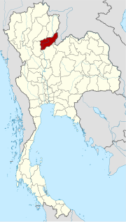  |
|


Uttaradit ( Thai : อุตรดิตถ์ , [ ʔùttàʔráʔdìt ]) is a province ( Changwat ) in the northern region of Thailand . The capital of the province of Uttaradit is also called Uttaradit .
The name Uttaradit means "northern port" and alludes to the importance of the provincial capital as a transshipment point for wood and other goods.
geography
The province is located about 490 kilometers north of the capital Bangkok .
location
Uttaradit is located in the lower part of the north in the valley of the Mae Nam Nan , where the Phi-Pan-Nam Mountains , foothills of the Southeast Asian mountain ranges , are already visible . The steep and undulating plains in the north and east of the province extend along the valleys of the Tron Canal, the Pat River, the Mae Phrong Canal and the Nam Krai Stream. In earlier times, the area was almost entirely covered by extensive teak forests that were felled over time, and today more than 38% of the land area is covered with forest.
| Neighboring provinces and areas: | |
|---|---|
| north | Phrae and Nan |
| east | Phitsanulok , Loei and national border with Laos |
| south | Phitsanulok |
| west | Sukhothai |
climate
The climate is tropical - monsoonal and, due to the increasing altitude above sea level, more pleasant than in the south of the country. The maximum temperature in 2008 was 40.2 ° C, the lowest temperature was measured at 10.9 ° C. On 99 rainy days fell 1183.3 mm of precipitation in the same year .
Economy and Importance
In 2008, the "Gross Provincial Product" (was GDP ) of the province 30.624 billion baht . The minimum wage in the province is 163 baht per day (around € 4).
Data
The table below shows the share of the economic sectors in the gross provincial product in percent:
| Industry | 2006 | 2007 | 2008 |
|---|---|---|---|
| Agriculture | 30.6 | 29.6 | 35.7 |
| Industry | 12.2 | 11.7 | 10.2 |
| Other | 57.2 | 58.7 | 54.1 |
The industry that made the greatest contribution to the province's economic output in 2011 was agriculture with 4.049 billion baht, followed by manufacturing with 3.083 billion baht and wholesale and retail with 1.955 billion baht.
Land use
The following land use is documented for the province:
- Forest area: 3,075,566 Rai (1,922.2 km²), 62.8% of the total area
- Agricultural area: 1,077,458 rai (673.4 km²), 22.0% of the total area
- Unclassified area: 746,095 rai (466.3 km²), 15.2% of the total area
In earlier times, the mining of teak was an important source of income. The timbers were rafted down the Mae Nam Nan and landed and sold at Uttaradit . After the logging ban, people had to reorient themselves. The main source of income is now agriculture and fishing, agriculture is mainly carried out in the lower plains. The most important crop is the Langsat fruit, which is widely grown here, followed by Durian , Rambutan and Mangosteen . The most important products from agriculture are rice and sugar cane.
Dams
- The Queen Sirikit Dam , located about 50 kilometers northeast of the provincial capital Uttaradit, led to improved irrigation and even more productive management after it was inaugurated in 1973.
history

The area of Uttaradit has been settled since prehistoric times, as finds at Wiang Chao Ngo, for example, show ( bronze knives and kettle drums). Until 10/11. In the 19th century, mountain people lived here on the slopes either as nomads or in small village communities.
Since the 11th century, Thai immigration from the north began to increase, but it was more peaceful. The Thai settled as rice farmers in the plains and on the river banks. Over time, a town called Bang Pho Tha It flourished here, serving as a transshipment point for goods from and to the north and lying on the right bank of the Mae Nam Nan .
After the fall of the Ayutthaya kingdom in 1767, a group of monks led by the charismatic abbot Phra Fang (Rüan) rebelled in Fang in what was then the province of Sawangkhaburi (today the temple Wat Phra Fang still stands east of today's provincial capital). They broke the Buddhist rules of the order ( Vinaya ) , were politically and militarily active and founded a short-lived state, which is sometimes referred to as the "monastic republic of Fang". On the other hand, Phra Fang can be found dubbed the “priest king”. In 1770 they took the neighboring province of Phitsanulok . In the same year they were beaten and executed by King Taksin , who incorporated the area into his newly founded kingdom of Thonburi .
In the 19th century the residents were relocated and King Rama V (Chulalongkorn) raised Uttaradit to a province ( Changwat ) with the newly named capital of the same name.
Attractions
-
National parks :
- Lam Nam Nan National Park
- Khlong Tron National Park
- Kaeng Dschek Kwa National Park
- Phu Soi Dao National Park (with the world's largest teak tree, 37 meters in circumference)
Symbols

seal
The seal of the province of Uttaradit shows the mondop of Wat Phra Thaen Sila At, a Buddhist temple complex ( Wat ) in the Amphoe Laplae. The temple is venerated because of a laterite block that is said to have helped the Buddha to his enlightenment. The Mondop was built on this laterite block.
The seal was designed in 1940, later the Garuda bird and the name of the province were added.
tree
The local tree is the teak tree ( Tectona grandis ).
Saying
The motto of the province of Uttaradit is:
- The land of swords made of high quality steel ,
- Sweet Langsat fruits can be seen everywhere
- The city of the brave hero Phraya Phichai ,
- He fought till his sword broke on his right side
- The world's largest teak tree is in this city.
Administrative units
Provincial Administration
Chat Kitti-Nophadon (Thai: ชั ช กิตติ นภดล ) has been the governor of the province since 2013 .
The province is divided into 9 Amphoe ('districts' or 'counties'). These are further subdivided into 67 tambon ('subdistricts' or 'municipalities') and 613 muban ('villages').
| No. | Amphoe | Thai | |
|---|---|---|---|
| 1. | Amphoe Mueang Uttaradit | อำเภอ เมือง อุตรดิตถ์ | |
| 2. | Amphoe Tron | อำเภอ ตรอน | |
| 3. | Amphoe Tha Pla | อำเภอ ท่าปลา | |
| 4th | Amphoe Nam Pat | อำเภอ น้ำปาด | |
| 5. | Amphoe Fak Tha | อำเภอ ฟากท่า | |
| 6th | Ban Khok district | อำเภอ บ้าน โคก | |
| 7th | Amphoe Phichai | อำเภอ พิชัย | |
| 8th. | Amphoe Laplae | อำเภอ ลับแล | |
| 9. | Amphoe Thong Saen Khan | อำเภอ ทอง แสน ขัน |

Local administration
A provincial administrative organization ( Thai องค์การ บริหาร ส่วน จังหวัด , short อบ จ. , Ongkan Borihan suan Changwat ; English Provincial Administrative Organization , PAO) exists for the entire area of the province .
There are 26 Thesaban ('municipalities') in the province - including a “city” ( เทศบาล เมือง - Thesaban Mueang): Uttaradit and 25 “small towns” ( เทศบาล ตำบล - Thesaban Tambon) - and 63 tambon administrative organizations.
Individual evidence
- ↑ uttaradit.go.th - location of the province
- ↑ uttaradit.go.th
- ↑ a b - Provincial resources
- ↑ uttaradit.go.th
- ↑ a b c Thailand in Figures (2011), p. 383.
- ^ Gross Provincial Product at Current Market Prices: Northern Provinces, National Economic and Social Development Board, 2011.
- ↑ - Economic branches of the province
- ↑ Uttaradit (brochure of the Tourism Authority of Thailand), 2011, p. 9.
- ^ Volker Grabowsky : Brief history of Thailand. CH Beck, Munich 2010, pp. 100-101.
- ↑ Patit Paban Mishra: The History of Thailand. Greenwood, 2010, p. 69.
- ↑ Somboon Suksamran: Buddhism and Politics in Thailand. Institute of Southeast Asian Studies, Singapore 1982, p. 25.
- ^ David K. Wyatt : Thailand. A short history. 2nd edition, Silkworm Books, Chiang Mai 2004, pp. 123–124.
- ↑ a b c - Symbols of Uttaradit
- ↑ - Governor of the province (in Thai)
- ↑ - Administrative units of the Uttaradit Province
- ↑ Department of Provincial Administration : As of 2012 (in Thai)
literature
- Thailand in Figures 2011. Nonthaburi: Alpha Research 13 A. 2011, ISBN 978-616752603-4 .
Web links
- Province website (in Thai) [last accessed October 23, 2013]
North : Chiang Mai | Chiang Rai | Kamphaeng Phet | Lampang | Lamphun | Mae Hong Son | Nakhon Sawan | Nan | Phayao | Phetchabun | Phichit | Phitsanulok | Phrae | Sukhothai | Tak | Uthai Thani | Uttaradit
Northeast : Amnat Charoen | Bueng Kan | Buri Ram | Chaiyaphum | Kalasin | Khon Kaen | Loei | Maha Sarakham | Mukdahan | Nakhon Phanom | Nakhon Ratchasima | Nong Bua Lam Phu | Nong Khai | Roi Et | Sakon Nakhon | Si Sa Ket | Surin | Ubon Ratchathani | Udon Thani | Yasothon
Central : Ang Thong | Ayutthaya | Bangkok | Chachoengsao | Chai Nat | Chanthaburi | Chon Buri | Kanchanaburi | Lop Buri | Nakhon Nayok | Nakhon Pathom | Nonthaburi | Pathum Thani | Phetchaburi | Prachin Buri | Prachuap Khiri Khan | Ratchaburi | Rayong | Sa Kaeo | Samut Prakan | Samut Sakhon | Samut Songkhram | Saraburi | Sing Buri | Suphan Buri | Stepped
South : Chumphon | Krabi | Nakhon Si Thammarat | Narathiwat | Pattani | Phang-nga | Phatthalung | Phuket | Ranong | Satun | Songkhla | Surat Thani | Trang | Yala
Coordinates: 17 ° 38 ' N , 100 ° 6' E