Chaiyaphum (Province)
| Chaiyaphum | |
|---|---|
| ชัยภูมิ | |

|
|
| statistics | |
| Capital: | Chaiyaphum |
| Telephone code: | 044 |
| Surface: |
12,778.3 km² 7. |
| Residents: |
1,125,166 (2009) 14. |
| Population density : | 88 E / km² 51. |
| ISO 3166-2 : | |
| Governor : | |
| map | |
Chaiyaphum ( Thai : ชัยภูมิ ) is a province ( Changwat ) in the northeast region of Thailand , the Isan . The capital of Chaiyaphum Province is also called Chaiyaphum .
etymology
The province's name literally means "land of victory" (from Sanskrit jaya , victory, and bhumi , land).
geography
Chaiyaphum is located on the western edge of the Isan, the distance to the capital Bangkok is about 350 kilometers.
The western half of the province consists of wild mountain landscape (part of the Phetchabun Mountains ) and forest, the eastern half belongs to the Khorat plateau .
| Neighboring provinces: | |
|---|---|
| north | Phetchabun and Khon Kaen |
| east | Khon Kaen |
| south | Nakhon Ratchasima |
| west | Lop Buri and Phetchabun |
Important cities
- Kaset Sombun, Nong Bua Daeng, Phakdi Chumphon
Important rivers
- Mae Nam Chi and the Mae Nam Phrom
Economy and Importance
In 2008, the "Gross Provincial Product" (was GDP ) of the province 45.677 billion baht . The minimum wage in the province is 165 baht per day (around € 4).
Data
The table below shows the share of the economic sectors in the gross provincial product in percent:
| Industry | 2006 | 2007 | 2008 |
|---|---|---|---|
| Agriculture | 24.0 | 26.8 | 26.2 |
| Industry | 12.7 | 12.5 | 13.1 |
| Other | 63.3 | 60.7 | 60.7 |
The industry that contributed the most to the province's economic output in 2011 was agriculture with 12.734 billion baht, followed by manufacturing with 8.506 billion baht and education with 7.203 billion baht.
Dams
- Chulabhorn Reservoir (Thai: เขื่อน จุฬา ภร ณ์ ) - the lake is located in the Amphoe Khon San and is a popular destination.
- The province of Chaiyaphum has a total of 735 wetlands with an area of 109.8 km², which are used more or less intensively for agriculture . Besides agriculture, silk production is an important economic factor in the province.
history
The area of today's Chaiyaphum Province belonged to the Khmer Empire of Angkor in the 12th century . In the early 19th century the area was repopulated by settlers from the Lao kingdoms of Vientiane , Loei , Phu Wiang and Nakhon Ratchasima (Khorat). The first head of the young community was Thao Lae, a vassal of King Anuvong of Vientiane, who gave him the title of Khun Phakdichumphon. After he had ceremonially assured King Anuvong of his loyalty in 1819, he refused to pay tribute three years later - influenced by the Bangkok-loyal Governor of Khorat - on the grounds that Anuvong himself was only a vassal of the King of Siam. King Rama III. thereupon raised him to the position of Phraya Phakdichumphon. In 1826 Anuvong moved against Bangkok ( Anuvong Rebellion ). At Chaiyaphum he was placed by the governor Pho Khun Lae, who, however, was killed in the ensuing battle. A statue of the hero, donated by the population, stands today in this place.
See also: History of Thailand , History of Wat Benchamabophit and corresponding entry in Chaiyaphum
population
99.4% of the population are Buddhists, 0.1% Muslim.
Agriculture employs around 79% of the workforce.
Attractions
- Wua Daeng - an interesting cave system that is a bit off the beaten track in the middle of a charming landscape
- Phu Khieo Wildlife Park ( Phu Khieo Wildlife Sanctuary ) - see web links
-
National parks :
- National Park Pa Hin Ngam (Thai: อุทยานแห่งชาติ ป่า หิน งาม ) - with a 846 meter high cliff ( edge of the earth ), which allows a wonderful view over the landscape; bizarre rock formations, as well as a large occurrence of the Siamese tulip
- Sai Thong National Park (Thai: อุทยานแห่งชาติ ไทรทอง ) - is located in the west of the province, with a beautiful waterfall
- Tat Thon National Park (Thai: อุทยานแห่งชาติ ตาด โตน ) - at Kaset Sombun, with beautiful waterfalls and abundant wildlife
Symbols
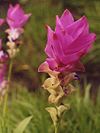
The seal of the province shows a triangular flag as a symbol of a won battle. The local tree is the cassod tree ( Cassia siamea ), the local flower is the Siamese tulip ( Curcuma alismatiflora ).
The motto of Chaiyaphum Province is:
- "Chaiyaphum is full of beautiful landscapes,
- Many elephants roam the great forests
- Lovely flowers can be seen everywhere
- Here is the statue of a famous hero Chao Pho Phraya Lae,
- The excellent Thai silk is known for its quality,
- This is where the highly revered Buddha image of Dvaravati was discovered. "
Administrative units
Provincial Administration
The province of Chaiyaphum is divided into 16 amphoe ('districts' or 'counties'). These are further subdivided into 124 tambon ('subdistricts' or 'municipalities') and 1393 muban ('villages').
|
Local administration
A provincial administrative organization ( Thai องค์การ บริหาร ส่วน จังหวัด , short อบ จ. , Ongkan Borihan suan Changwat ; English Provincial Administrative Organization , PAO) exists for the entire area of the province .
The province also has 35 thesaban ('communes') - including a "city" (the provincial capital) and 34 "small towns" - and 107 tambon administrative organizations.
literature
- Thailand in Figures . 13. A. Nonthaburi: Alpha Research 2011. ISBN 9786167526034 .
Web links
- Overview map of the province (names in English and Thai) [last accessed on November 12, 2013]
Individual evidence
- ↑ a b Thailand in Figures (2011), p. 317
- ^ Gross Provincial Product at Current Market Prices: Western Provinces, National Economic and Social Development Board, 2011.
- ↑ Edmund JV Oh, Blake D. Ratner, Simon Bush, Komathi Kolandai and Terence Y. Too (eds.): Wetlands Governance in the Mekong Region: country reports on the legal-institutional framework and economic valuation of aquatic resources . 2005.
- ↑ Mayoury Ngaosyvathn, Pheuiphanh Ngaosyvathn: Paths to Conflagration. Fifty Years of Diplomacy and Warfare in Laos, Thailand, and Vietnam, 1778–1828. Cornell Southeast Asia Program, Ithaca NY 1998, ISBN 0-87727-723-0 , pp. 42-43.
Coordinates: 15 ° 48 ' N , 102 ° 2' E


