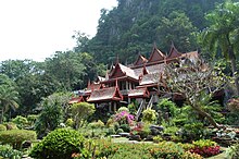
Uthai Thani (Province)
| Uthai Thani | |
|---|---|
| อุทัยธานี | |
| statistics | |
| Capital: | Uthai Thani |
| Telephone code: | 056 |
| Surface: |
6,730.2 km² 30. |
| Residents: |
327,871 (2009) 66. |
| Population density : | 47 E / km² 66. |
| ISO 3166-2 : | |
| Governor : | |
| map | |
Uthai Thani ( Thai : อุทัยธานี ) is a province ( Changwat ) in the southern part of the northern region of Thailand . The capital of Uthai Thani Province is also called Uthai Thani .
geography
The province extends from the plain of Mae Nam Chao Phraya to the gently sloping mountain ranges in the west, which are covered with lush evergreen forest.
The Huai Kha Khaeng Wildlife Sanctuary - on the western border of the province of Tak lied, since 1991, World Heritage of UNESCO . It covers around 2,600 km² and is home to practically all forest-native species of Southeast Asia , including tigers and elephants .
| Bordering provinces: | |
|---|---|
| north | Nakhon Sawan |
| east | Chai Nat |
| south | Suphan Buri and Kanchanaburi |
| west | Tak |
Important rivers
climate
The climate is tropical - monsoonal .
population
Mainly Thais live in Phichit . In addition, there are also descendants of the Lao Khrang , the Lao Khrang , who were abducted by Siamese from Laos , the total number of which in Thailand is 53,000.
history
Originally, Mon and Lawa settled in the area. During the Sukhothai period, the city of U Thai was established as the first Tai settlement. The city was abandoned when the river changed direction. A Karen chief named Pata Beut revived the settlement and placed it in its current location during the Ayutthaya period . A fort was also built here, which served as a border defense against the frequent raids by the Burmese.
In 1892 the area around Uthai Thani was added to the Monthon Nakhon Sawan , it was not until 1898 that King Chulalongkorn (Rama V) formed what is now the province of Uthai Thani.
Economy and Importance
In 2008, the "Gross Provincial Product" (was GDP ) of the province of 21,107 million baht . The minimum wage in the province is 168 baht per day (around € 4).
Data
The table below shows the share of the economic sectors in the gross provincial product in percent:
| Industry | 2006 | 2007 | 2008 |
|---|---|---|---|
| Agriculture | 36.2 | 33.8 | 38.6 |
| Industry | 4.4 | 11.0 | 10.1 |
| Other | 59.4 | 55.2 | 51.3 |
Land use
The following land use is documented for the province:
- Forest area: 2,170,627 Rai (1,356.6 km²), 51.6% of the total area
- Agricultural area: 1,378,701 Rai (861.7 km²), 32.8% of the total area
- Unclassified area: 657,076 rai (410.7 km²), 15.6% of the total area
coat of arms
The coat of arms of the province shows the pavilion of Wat Khao Sakae Krang . The temple complex ( Wat ) houses the statue of Thong Di, the father of the later King Phra Phutthayotfa Chulalok (Rama I) , the founder of the Chakri dynasty, which is still ruling today . The mountains in the background symbolize the position of the temple on a mountain.
The local tree is the yellow cotton tree ( Cochlospermum regium ). The local flower is the neem tree ( Azadirachta indica v. Siamensis ).
The motto of Uthai Thani Province is:
The city of the ancestors of the Chakri Dynasty ,
wheel, a tasty fish species calls for Trial ends,
the land of religious rite called Tak Bat Thewo,
in the village of Nam Tok best grow pomelos ,
here is the world heritage Huai Kha Khaeng.
Attractions
- Wat Sankat Rattana Khiri - with an old bronze Buddha image from the Sukhothai period
- Wat Ubosatharam - octagonal multi-gable roof and an exhibition of artifacts from the area
- Khao Pla Ra - prehistoric wall paintings around nine meters long
- Wat Tham Khao Wong - beautiful temple in the middle of a valley, two-story assembly hall
- old teak trees in the Lan Sak district
Administrative units
Provincial Administration
The province is divided into eight districts ( Amphoe ), which are further subdivided into 70 municipalities ( Tambon ) and 589 villages ( Muban ).
|
Local administration
A provincial administrative organization ( บริหาร ส่วน จังหวัด , อบ จ for short , Ongkan Borihan suan Changwat ; English Provincial Administrative Organization , PAO) exists for the entire area of the province .
There is one state ( Stand เมือง - Thesaban Mueang ) in the province : Uthai Thani ( เทศบาล เมือง อุทัยธานี ). There are also 10 small towns ( เทศบาล ตำบล - Thesaban Tambon ).
literature
- Thailand in Figures 2011 . 13th edition. Alpha Research, Nonthaburi 2011, ISBN 978-616752603-4 .
Web links
- Overview map of the province (names in Thai and English) accessed on November 12, 2013
Individual evidence
- ↑ a b c Thailand in Figures . 2011, p. 385.
- ↑ Department of Provincial Administration : As of 2012 (in Thai)
Coordinates: 15 ° 22 ′ N , 100 ° 2 ′ E


