
Nakhon Phanom (Province)
| Nakhon Phanom | |
|---|---|
| นครพนม | |

|
|
| statistics | |
| Capital: | Nakhon Phanom |
| Telephone code: | 042 |
| Surface: |
5,512.7 km² 39. |
| Residents: |
700,690 (2009) 33. |
| Population density : | 127 E / km² 35. |
| ISO 3166-2 : | |
| Governor : | Somchai Witdamrong |
| map | |
  |
|


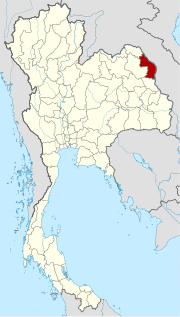
Nakhon Phanom ( Thai : นครพนม ) is a province ( Changwat ) in the northeast region of Thailand , the Isan . The capital of the Nakhon Phanom province is also called Nakhon Phanom .
geography
Nakhon Phanom is a border province to Laos and is located in the Mekong valley across from Thakhek in the province of Khammuan , Laos. Nakhon Phanom is about 740 kilometers northeast of the capital Bangkok .
| Neighboring provinces and areas: | |
|---|---|
| north | Bueng Kan |
| east | Khammuan Province Laos (on the other side of the Mekong ) |
| south | Mukdahan |
| west | Sakon Nakhon |
Important cities
Important rivers
climate
The climate is tropical - monsoonal .
Economy and Importance
In 2011, the "Gross Provincial Product" (was GDP ) of the province 29.611 billion baht .
Data
The table below shows the share of the economic sectors in the "Gross Provincial Product" in percent:
| Industry | 2006 | 2007 | 2008 |
|---|---|---|---|
| Agriculture | 28.3 | 26.6 | 28.3 |
| Industry | 2.0 | 2.9 | 2.6 |
| Other | 69.7 | 70.5 | 69.1 |
The industry that contributed most to the province's economic output in 2011 was agriculture with 9.014 billion baht, followed by education with 5.347 billion baht and wholesale and retail with 2.736 billion baht.
Natural areas and agriculture
The province of Nakhon Phanom has a total of 837 wetlands with an area of 112.9 km², which are used more or less intensively for agriculture .
traffic
In the province of Nakhon Phanom there is one end point of the Thai national road 22 . It connects Nakhon Phanom to Udon Thani via Sakon Nakhon . Nakhon Phanom has been connected to Thakhek , the capital of the Laotian province of Khammuan , via the Third Thai-Lao Friendship Bridge since 2011 .
Airport
history
The landscape of the province of Nakhon Phanom was already settled in the earliest Bronze Age. In fact, it is believed that the first bronzes were made here in Southeast Asia several centuries before those in the Near East.
In the seventh and eighth centuries, large areas of Isaan came under the rule of Dvaravati and were later conquered by the Khmer . After the fall of the Angkor empire in the 13th century, the rule of the Lao empire Lan Xang (from the area around Vientiane ) began. The then deserted area was more and more occupied by Laotian settlers who established a rice culture.
After the Ayutthaya Empire took possession of the area, Laotian migration continued here until the 19th century, as the population wanted more settlers. The French - Siamese treaties of 1893 and 1904 also made Nakhon Phanom the border between Siam and French Indochina .
After the Communist Party of Thailand had turned to the armed struggle, fighting between the “People's Liberation Army” and government troops took place here from 1965 onwards.
population
The population is mainly of Lao descent.
The food here consists more of sticky rice and goi, a preparation of meat and vegetables cut up with a mortar , mixed with coagulated beef blood.
education
This province is home to the Nakhon Phanom University , which was formed in 2005 from the merger of several predecessor institutions.
Attractions
- Wat Phra That Phanom - about 50 kilometers south of the provincial capital; it is the most revered religious site of Buddhism in northeast Thailand. It is both the Thai and the Lao people visited
- Phrathat Renu Nakhon - consists of a similar system as Prathat Phanom, is only slightly smaller
- Boat processions - on the Mekong there are processions with illuminated boats when the moon is full at the end of October / beginning of November.
- Phu Pha Yon National Park - located in the southwest of the province
Symbols

The seal of the Nakhon Phanom province shows the 57 meter high chedi of Wat Phra That Phanom in Amphoe That Phanom .
The local tree and flower is the Tembesu ( Fragraea fragrans ).
The motto of Nakhon Phanom Province is:
- "The city of the very valuable Phra That Phanom Shrine,
- The land of various tribal cultures,
- The seat of the Renu Phu Thai tribe,
- Illuminated boat processions can be seen every year
- along the attractive banks of the Mekong . "
Administrative units
Provincial Administration
Nakhon Phanom Province is divided into Amphoe ('districts' or 'counties'). The counties are further subdivided into 97 tambon ('subdistricts' or 'municipalities') and 1040 muban ('villages').
|

Local administration
A provincial administrative organization ( Thai องค์การ บริหาร ส่วน จังหวัด , short อบ จ. , Ongkan Borihan suan Changwat ; English Provincial Administrative Organization , PAO) exists for the entire area of the province .
In the area of the province there are also 23 thesaban ('municipalities') - including three "cities" and 20 "small towns" - and 79 tambon administrative organizations.
literature
- Thailand in Figures . 13. A. Nonnthaburi: Alpha Research 2011. ISBN 978-6167526034 .
Web links
- Province website (in Thai)
- Overview map of the province (names in English and Thai) [last accessed on November 2, 2013]
Individual evidence
- ^ Ashes of ex-Seal Saman scattered on Mekong River
- ^ A b Gross Provincial Product at Current Market Prices: Northeastern Provinces, National Economic and Social Development Board, 2011.
- ↑ Thailand in Figures . 13th edition 2011, p. 319.
- ↑ Edmund JV Oh, Blake D. Ratner, Simon Bush, Komathi Kolandai and Terence Y. Too (eds.): Wetlands Governance in the Mekong Region: country reports on the legal-institutional framework and economic valuation of aquatic resources . 2005.
North : Chiang Mai | Chiang Rai | Kamphaeng Phet | Lampang | Lamphun | Mae Hong Son | Nakhon Sawan | Nan | Phayao | Phetchabun | Phichit | Phitsanulok | Phrae | Sukhothai | Tak | Uthai Thani | Uttaradit
Northeast : Amnat Charoen | Bueng Kan | Buri Ram | Chaiyaphum | Kalasin | Khon Kaen | Loei | Maha Sarakham | Mukdahan | Nakhon Phanom | Nakhon Ratchasima | Nong Bua Lam Phu | Nong Khai | Roi Et | Sakon Nakhon | Si Sa Ket | Surin | Ubon Ratchathani | Udon Thani | Yasothon
Central : Ang Thong | Ayutthaya | Bangkok | Chachoengsao | Chai Nat | Chanthaburi | Chon Buri | Kanchanaburi | Lop Buri | Nakhon Nayok | Nakhon Pathom | Nonthaburi | Pathum Thani | Phetchaburi | Prachin Buri | Prachuap Khiri Khan | Ratchaburi | Rayong | Sa Kaeo | Samut Prakan | Samut Sakhon | Samut Songkhram | Saraburi | Sing Buri | Suphan Buri | Stepped
South : Chumphon | Krabi | Nakhon Si Thammarat | Narathiwat | Pattani | Phang-nga | Phatthalung | Phuket | Ranong | Satun | Songkhla | Surat Thani | Trang | Yala
Coordinates: 17 ° 24 ' N , 104 ° 47' E