Nakhon Phanom
|
นครพนม Nakhon Phanom |
||
|---|---|---|
|
|
||
| Coordinates | 17 ° 25 ′ N , 104 ° 47 ′ E | |
| Basic data | ||
| Country | Thailand | |
| Nakhon Phanom | ||
| ISO 3166-2 | TH-48 | |
| Residents | 26,623 (2012) | |
|
Seat of the city council of Nakhon Phanom
|
||

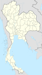
Nakhon Phanom ( Thai นครพนม ) is a city in northeast Thailand , on the west bank of the Mekong , opposite the Laotian city of Thakhek . It has the administrative status of a Thesaban Mueang and is the capital of the district ( Amphoe ) Mueang Nakhon Phanom and the province of Nakhon Phanom .
etymology
The name Nakhon Phanom is composed of the Sanskrit word Nakhon (city) and the Khmer phnŏm (hill) , meaning "city of hills". However, this refers to the hills in neighboring Laos that rise on the eastern horizon.
geography
Nakhon Phanom is located on the extreme northeastern border of Thailand on the border with Laos on the banks of the Mekong .
The city of Nakhon Phanom consists of the entire tambon Nai Mueang and Nong Saeng and parts of the tambon At Samat and Nong Yat. In 2006 the population was 27,591.
climate
|
Monthly average temperatures and rainfall for Nakhon Phanom
Source: ??
|
economy
The place has a regional airport ( Nakhon Phanom Airport ). There is also an air force base (Royal Thai Air Base - RTAB), which was used by the US armed forces during the Vietnam War. At that time there were also eavesdropping devices here.
history
During the Vietnam War , Nakhon Phanom took in many refugees from the states of Indochina.
Attractions
- Wat Mahathat ( วัด มหาธาตุ ) - Buddhist temple complex ( Wat ) on the banks of the Mekong
- Wat Srithep Pradittharam ( วัดศรีเทพ ประดิษ ฐา ราม ) - worth seeing wall paintings in the Ubosot , a statue of the monk Luang Phu Chan is very revered by the population.
traffic
Nakhon Phanom is the end point of the Thai National Road 22 (Thanon Nittayo) . Since 2011 it has been connected to the Lao city of Thakhek across the street via the Third Thai-Laotian Friendship Bridge.
Others
- In the village of Ban Na Chok of Tambon Nong Yat, district Mueang Nakhon Phanom ( .. บ้านนา จอก หมู่ ที่ 5 ตำบล หนอง ญาติ อ เมือง นครพนม จ นครพนม ) there is a small Ho Chi Minh Museum ( บ้าน โฮ จิ มิ น ห์ - Ban Ho Chi Minh ). The Vietnamese revolutionary Ho Chi Minh lived here on the banks of the Mekong from July 1928 until the end of 1929 before he traveled on to Hong Kong and Shanghai. You can see photos and some memorabilia of "Lung Ho", as it is called by the locals.
Personalities
- Watchara Mahawong (born 1983), soccer player
- Tatree Seeha (* 1983), soccer player
- Pornsak Pongthong (born 1987), football player
- On-uma Chattha (* 1997), athlete
Individual evidence
- ↑ TAT e-magazine about the City of Hills ( Memento from August 16, 2008 in the Internet Archive ) (English)
- ↑ side of the Bangkok Post about the museum (in English)
Web links
- City map of Nakhon Phanom (names in Thai and English) [last accessed November 2, 2013]


