Wang Yang District
|
Wang Yang วัง ยาง |
|
|---|---|
| Province: | Nakhon Phanom |
| Surface: | 137.9 km² |
| Residents: | 15,187 (2013) |
| Population density : | 104.7 U / km² |
| ZIP : | 48130 |
| Geocode : | 4812 |
| map | |

|
|
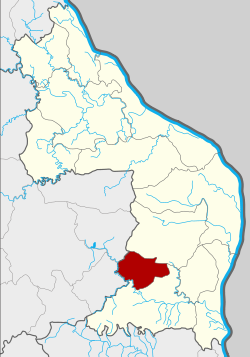
Location of Wang Yang District |
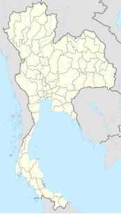
Wang Yang District ( Thai : อำเภอ วัง ยาง ) is a district ( Amphoe - administrative district) of the province of Nakhon Phanom . The province of Nakhon Phanom is located in the northeast region of Thailand , the so-called Isan .
geography
Neighboring districts (clockwise from north): Pla Pak and Na Kae districts in Nakhon Phanom Province and Khok Si Suphan and Phon Na Kaeo districts in Sakon Nakhon Province .
history
Wang Yang was established on July 1, 1997 as a "branch circle" ( King Amphoe ) by separating four tambon from the Na Kae district .
On May 15, 2007 the Thai government decided to raise all 81 King Amphoe to simple amphoe status in order to unify the administration. With the publication in the Royal Gazette "Issue 124 chapter 46" on August 24, 2007 this decision officially entered into force.
administration
Provincial Administration
Amphoe That Phanom is divided into four communities ( Tambon ) , which in turn are divided into 27 villages ( Muban ) .
| No. | Surname | Thai | Muban | Pop. |
|---|---|---|---|---|
| 1. | Wang Yang | วัง ยาง | 9 | 4,823 |
| 2. | Khok Si | โคก สี | 7th | 3,198 |
| 3. | Yot chat | ยอด ชาด | 7th | 4,999 |
| 4th | Nong Pho | หนอง โพธิ์ | 4th | 2,051 |
Local administration
There is no city ( Thesaban ) in the district. Each of the four tambon is administered by a "Tambon Administrative Organization" (TAO, องค์การ บริหาร ส่วน ตำบล - Administrative Organization).
Individual evidence
- ↑ ประกาศ กระทรวง มหาดไทย เรื่อง แบ่ง เขต ท้องที่ อำเภอ นาแก จังหวัด นครพนม ตั้ง เป็น กิ่ง อำเภอ วัง ยาง . In: Royal Gazette . 116, No. 51 ง พิเศษ (special), June 25, 1997, p. 8.
- ↑ www.manager.co.th
- ↑ พระราชกฤษฎีกา ตั้ง อำเภอ ฆ้องชัย ... และ อำเภอ เหล่า เสือ โก้ ก พ.ศ. ๒๕๕๐ Royal Gazette, Volume 124, Issue 46 ก of August 24, 2007, pp. 14-21 (in Thai)
- ↑ Population statistics 2012 . Department of Provincial Administration. Retrieved April 8, 2014.
Web links
Coordinates: 17 ° 3 ' N , 104 ° 27' E

