
Chanthaburi Province
| Chanthaburi | |
|---|---|
| จันทบุรี | |
.svg)
|
|
| statistics | |
| Capital: | Chanthaburi |
| Telephone code: | 039 |
| Surface: |
6,338 km² 34. |
| Residents: |
511.246 (2009) 50. |
| Population density : | 81 E / km² 64. |
| ISO 3166-2 : | |
| Governor : | |
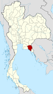
| map | |
  |
|
Chanthaburi ( Thai : จันทบุรี ) is a province ( Changwat ) in eastern Thailand , but administratively it is counted as part of central Thailand .
location
The province of Chanthaburi lies on the border with Cambodia and on the coast of the Gulf of Thailand . While the coastal landscape is rather flat, the land rises to the northeast towards a sizeable mountain range that forms the natural border with Cambodia, the so-called Cardamom Mountains . The highest point in the province is at Soi Dao Nua and reaches a height of 1556 meters above sea level.
| Adjacent provinces and areas: | |
|---|---|
| north | Chachoengsao and Sa Kaeo |
| east | Trat and land border with Cambodia |
| south | Gulf of Thailand |
| west | Rayong and Chon Buri |
climate
The climate is tropical - monsoonal . In 2009 there was a rainfall of 3,099 mm on 165 rainy days . In the same year the maximum temperature was 35.4 ° C and the lowest temperature was 19.0 ° C.
Economy and Importance


In 2008, the "Gross Provincial Product" (was GDP ) of the province of 41,538 million baht . The minimum wage in the province has been 179 Baht (around 4.5 euros) since January 1, 2011.
Data
The table below shows the share of the economic sectors in the "Gross Provincial Product" in percent:
| Industry | 2006 | 2007 | 2008 |
|---|---|---|---|
| Agriculture | 27.0 | 29.3 | 30.6 |
| Industry | 5.8 | 6.0 | 5.9 |
| Other | 67.2 | 64.7 | 63.5 |
Industries
Almost half of the area of Chanthaburi Province is designated as arable land, while a little more than a third consists of forest land.
In addition to agriculture with rice cultivation and tropical fruits, there is also a production of precious stones and gemstones in the province , with rubies and sapphires in particular being mined and processed.
population

In addition to the dominant Thais , many Khmer live in Chanthaburi Province, a significant number of whom were brought here from neighboring Cambodian provinces in the 18th and 19th centuries. Most of their descendants are assimilated . In the 2000 census, 1.6% said they spoke Khmer or the related Kuy as their first language.
Many residents of Chanthaburi Province are native or descended from Vietnamese . Vietnamese immigrated to Thailand in three waves:
- in the 19th century during the anti- Catholic attacks in Cochinchina (at that time already part of the Empire of Vietnam )
- Refugees from Indochina during the 20s to 40s years of the 20th century
- a shaft according to the victory of the Communists from North Vietnam in 1975 about the USA and South Vietnam .
As a result, Chanthaburi Province has a large Catholic community by Thai standards. According to the 2000 census, 1.8% of the population was Christian. Chanthaburi is the seat of a Roman Catholic diocese . Their episcopal church, the Cathedral of the Immaculate Conception, is one of the largest Catholic churches in Thailand.
education
- Rambhaibarni Rajabhat University
- Burapha University , Chanthaburi Campus
- Rajamangala University of Technology Tawan-ok , Chanthaburi Campus
- Sukhothai Thammathirat Open University , Chanthaburi Campus
history
The landscape west of Cambodia was ruled by the Khmer and their ancient kingdom Angkor early on , before the Siamese from Ayutthaya could expand their influence in the 15th century . After that there were repeated attacks to and from Cambodia, but no change in the territorial status. Most of the raids served to take goods and, above all, valuable workers to Cambodia or to fetch them from there. After the destruction of Ayutthaya by the Burmese in 1767, Chanthaburi served as the headquarters for the army of General Taksin (later King of Thonburi ) who led Siam back to independence until around 1770 .
During the Pak-Nam incident in 1893, French colonial troops from French Indochina occupied Chanthaburi and did not retreat until 1905 after the Siamese ceded the western provinces of Cambodia to France.
.jpg)
Attractions
- The Khao Soi Dao Wildlife Sanctuary ( สัตว์ ป่า เขา สอยดาว ) in Soi Dao County is 70 kilometers north of the provincial capital.
- Khao Chamao National Park - Khao Wong - located on the border with Rayong Province.
- Khao Khitchakut National Park with the Krathing Waterfall - 30 kilometers from Chanthaburi, you can still see many wild animals there. There is a footprint of Buddha on the top of Khitchakut Mountain .
- Namtok Phlio National Park ( น้ำตก พลิ้ว , Pliew) - large park with the Phliu waterfall and a stupa donated by King Chulalongkorn (Rama V) .
- Laem Sing ( Lion Cape ) - with a fortress containing Khuk Khi Gai ( คุก ขี้ ไก่ , chicken dung prison) - about 30 kilometers south of the city near the pier ; the name is due to the fact that the building has been used as a prison by French occupation forces since the Pak-Nam incident in 1893 . A chicken coop is said to have been established on the top floor, from which the chicken manure is said to have fallen through the perforated roof into the lower floors.
Symbols
The seal of Chanthaburi province shows the moon surrounded by an aura. Inside the lunar disc is a hare , as the Thai believe that the mare of the moon (the dark areas) take the form of a hare. The seal is supposed to symbolize the peace and tranquility of the province. It is also talking is the name of the province, which translates as "Moon City".
The local tree is Diospyros decandra . The local flower is the orchid .
The motto of Chanthaburi Province is:
- "City of famous waterfalls ,
- With an abundance of local fruits
- The land where the best pepper grows
- Many gemstones are cut here
- Moved bast mats are very well known here,
- Rich in lush natural beauty,
- The city that commemorates King Taksin's great deeds,
- When he brought everyone together to defeat the Burmese . "
Administrative units
Provincial Administration
The province is divided into ten Amphoe ('districts' or 'counties'). The districts are further subdivided into 76 tambon ('sub-districts' or 'parishes') and 690 muban ('villages').
|

Local administration
A provincial administrative organization ( บริหาร ส่วน จังหวัด , อบ จ for short , Ongkan Borihan suan Changwat ; English Provincial Administrative Organization , PAO) exists for the entire area of the province .
There are five cities ( เทศบาล เมือง - Thesaban Mueang ) and 23 small towns ( เทศบาล ตำบล - Thesaban Tambon ) in the province .
Individual evidence
- ↑ Thailand in Figures (2011), p. 281
- ↑ a b Thailand in Figures (2011), p. 282
- ↑ a b Key indicators of the population and households, Population and Housing Census 1990 and 2000: Chanthaburi
- ↑ Department of Provincial Administration : As of 2012 (in Thai)
literature
- Thailand in Figures . 13. A. Nonthaburi: Alpha Research 2011. ISBN 978-616-752603-4 .
Web links
North : Chiang Mai | Chiang Rai | Kamphaeng Phet | Lampang | Lamphun | Mae Hong Son | Nakhon Sawan | Nan | Phayao | Phetchabun | Phichit | Phitsanulok | Phrae | Sukhothai | Tak | Uthai Thani | Uttaradit
Northeast : Amnat Charoen | Bueng Kan | Buri Ram | Chaiyaphum | Kalasin | Khon Kaen | Loei | Maha Sarakham | Mukdahan | Nakhon Phanom | Nakhon Ratchasima | Nong Bua Lam Phu | Nong Khai | Roi Et | Sakon Nakhon | Si Sa Ket | Surin | Ubon Ratchathani | Udon Thani | Yasothon
Central : Ang Thong | Ayutthaya | Bangkok | Chachoengsao | Chai Nat | Chanthaburi | Chon Buri | Kanchanaburi | Lop Buri | Nakhon Nayok | Nakhon Pathom | Nonthaburi | Pathum Thani | Phetchaburi | Prachin Buri | Prachuap Khiri Khan | Ratchaburi | Rayong | Sa Kaeo | Samut Prakan | Samut Sakhon | Samut Songkhram | Saraburi | Sing Buri | Suphan Buri | Stepped
South : Chumphon | Krabi | Nakhon Si Thammarat | Narathiwat | Pattani | Phang-nga | Phatthalung | Phuket | Ranong | Satun | Songkhla | Surat Thani | Trang | Yala
Coordinates: 12 ° 37 ' N , 102 ° 6' E