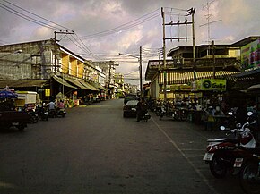
Amphoe Tha Mai
|
Tha Mai ท่าใหม่ |
|
|---|---|
| Province: | Chanthaburi |
| Surface: | 612.8 km² |
| Residents: | 70,463 (2013) |
| Population density : | 121.1 U / km² |
| ZIP : | 22170, 22120 |
| Geocode : | 2203 |
| map | |

|
|
Amphoe Tha Mai ( Thai : อำเภอ ท่าใหม่ ) is a district ( amphoe - administrative district) in Chanthaburi Province . The Chanthaburi Province is located in the east of the central region of Thailand .
geography
Neighboring Amphoe (clockwise from west): Na Yai Am , Kaeng Hang Maeo , Khao Khitchakut , Mueang Chanthaburi and Laem Sing Amphoe of Chanthaburi Province. In the southwest lies the Gulf of Thailand .
history
Amphoe Tha Mai was established in 1900 under the name Khamong ( โขมง ). Four years later, the administration was moved to the vicinity of Wat Khao Phloi Waen and the district was renamed accordingly to Phloi Waen ( พลอย แหวน ). When the administration was relocated again to Tambon Tha Mai in 1917, the district was also renamed Tha Mai after the central tambon .
education
The Chanthaburi campus of Burapha University is located in Tha Mai district .
administration
Provincial Administration
The district of Tha Mai is divided into 14 tambon ("sub-districts" or "municipalities"), which are further subdivided into 124 muban ("villages").
| No. | Surname | Thai | Muban | Pop. |
|---|---|---|---|---|
| 1. | Tha May | ท่าใหม่ | - | 8,018 |
| 2. | Yai Ra | ยาย ร้า | - | 1,837 |
| 3. | Si Phaya | สี พ ยา | 11 | 1,637 |
| 4th | Bo Phu | บ่อ พุ | 8th | 1,296 |
| 5. | Phloi Waen | พลอย แหวน | 7th | 1,614 |
| 6th | Khao Wua | เขา วัว | 9 | 3,533 |
| 7th | Khao Baisi | เขา บายศรี | 12 | 7,465 |
| 8th. | Song Phi Nong | สองพี่น้อง | 17th | 7,419 |
| 9. | Thung Bencha | ทุ่ง เบญจา | 14th | 11,693 |
| 11. | Ramphan | รำพัน | 10 | 3,532 |
| 12. | Khamong | โขมง | 6th | 3,047 |
| 13. | Takat Ngao | ตะกาด เง้า | 10 | 7,588 |
| 14th | Khlong Khut | คลอง ขุด | 10 | 4,872 |
| 24. | Khao Kaeo | เขา แก้ว | 10 | 6,912 |
Note: the missing geocodes belong to the tambon that are today in Kaeng Hang Maeo and Na Yai Am .
Local administration
There is one commune with "city" status ( Thesaban Mueang ) in the district:
- Tha Mai (Thai: เทศบาล เมืองท่า ใหม่ ) consisting of the complete Tambon Tha Mai, Yai Ra.
There are five municipalities with "small town" status ( Thesaban Tambon ) in the district:
- Khao Wua - Phloi Waen (Thai: เทศบาล ตำบล เขา วัว - พลอย แหวน ) consisting of the complete tambon Phloi Waen and parts of the tambon Khao Wua.
- Song Phi Nong (Thai: เทศบาล ตำบล สองพี่น้อง ) consisting of the complete tambon Song Phi Nong.
- Noen Sung (Thai: เทศบาล ตำบล เนิน สูง ) consisting of the parts of the tambon Khao Wua, Khao Baisi.
- Nong Khla (Thai: เทศบาล ตำบล หนอง คล้า ) consisting of parts of the Tambon Thung Bencha.
- Khao Baisi (Thai: เทศบาล ตำบล เขา บายศรี ) consisting of parts of the Tambon Khao Baisi.
In addition, there are seven " Tambon Administration Organizations " ( องค์การ บริหาร ส่วน ตำบล - Tambon Administrative Organizations, TAO)
- (Thai: องค์การ บริหาร ส่วน ตำบล สี พ ยา - บ่อ พุ ) consisting of the complete Tambon Si Phaya, Bo Phu.
- Thung Bencha (Thai: องค์การ บริหาร ส่วน ตำบล ทุ่ง เบญจา ) consisting of parts of the tambon Thung Bencha.
- Ramphan (Thai: องค์การ บริหาร ส่วน ตำบล รำพัน ) consisting of the complete Tambon Ramphan.
- Khamong (Thai: องค์การ บริหาร ส่วน ตำบล โขมง ) consisting of the complete Tambon Khamong.
- Takat Ngao (Thai: องค์การ บริหาร ส่วน ตำบล ตะกาด เง้า ) consisting of the complete tambon Takat Ngao.
- Khlong Khut (Thai: องค์การ บริหาร ส่วน ตำบล คลอง ขุด ) consisting of the complete tambon Khlong Khut.
- Khao Kaeo (Thai: องค์การ บริหาร ส่วน ตำบล เขา แก้ว ) consisting of the complete Tambon Khao Kaeo.
Individual evidence
- ↑ ประกาศ กระทรวง มหาดไทย เรื่อง เปลี่ยน ชื่อ อำเภอ . In: Royal Gazette . 34, No. 0 ก , April 29, 1917, pp. 40-68.
- ↑ 2013 population statistics ( Thai ) Department of Provincial Administration. Retrieved October 8, 2014.
Web links
Coordinates: 12 ° 37 ' N , 102 ° 1' E

