
Satun (province)
| Satun | |
|---|---|
| สตูล | |

|
|
| statistics | |
| Capital: | Satun |
| Telephone code: | 074 |
| Surface: |
2,479.0 km² 63. |
| Residents: |
293.101 (2009) 67. |
| Population density : | 118 E / km² 42. |
| ISO 3166-2 : | |
| Governor : | |
| map | |
  |
|
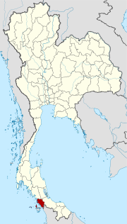
Satun ( Thai สตูล [ sā.tūːn ]) is a province ( Changwat ) in the southern region of Thailand . The capital of the province is also called Satun .
etymology
The name Satun is the Thai version of its Malay name Setul ( Santol , or Wild Mangosteen Tree ).
geography
Satun is located in the south of Thailand , about 970 kilometers from Bangkok on the west coast of the Malay Peninsula on the Strait of Malacca . The landscape is mountainous with a low plain towards the sea.
The province includes more than 60 larger and smaller islands, most of them are protected in national parks. Of: in the province the following national parks are Thale Ban National Park , the National Park Tarutao and the National Park Mu Ko Phetra .
| Adjacent provinces and areas: | |
|---|---|
| north | Trang and Phatthalung |
| east | Songkhla |
| south | Border with Malaysia |
| west | Coast to the Indian Ocean |
climate
The climate is tropical - monsoonal . In 2000 the number of rainy days was 212 with a rainfall of 2642 mm. The maximum temperature in 2008 was 34.7 ° C, the lowest temperature was measured at 21.9 ° C. On 176 rainy days fell in the same year 2584.2 mm of precipitation.
Economy and Importance
Data
In 2011, the "Gross Provincial Product" (was GDP ) of the province 33.951 billion baht.
Wirtschaftszweig 2006  2007  2008
Landwirtschaft 29,9  30,4  31,2
Industrie 11,8  11,8  13,0  Alle Angaben in %
Andere 58,3  57,8  55,8
The minimum wage in the province is 173 baht per day (around € 4).
The industry that made the greatest contribution to the province's economic output in 2011 was agriculture with 12.243 billion baht, followed by fishing with 4.970 billion baht, manufacturing with 4.193 billion baht, and wholesale and retail with 4.066 billion baht .
Land use
The following land use is documented for the province:
- Forest area : 601,558 Rai (376.0 km²), 38.8% of the total area
- Agricultural area : 470,691 Rai (294.2 km²), 30.4% of the total area
- Unclassified area : 477,112 rai (298.2 km²), 30.8% of the total area
Airport
Satun itself does not have an airport, but can be reached by plane via Trang and Hat Yai .
- Trang (IATA code TST), Hat Yai (HDY)
history
Until 1813, Satun was a district called Mukim Setul in the Malay sultanate of Kedah . After a failed attempt at independence by the Sultan of Kedah, the Siamese King Rama III ordered. (Phra Nang Klao) In 1833 the splitting of Kedah into four separate mueang an: Kubang Pasu, Saiburi (the Siamese name for Kedah), Perlis and Satun. Mueang Satun was placed under the administration of Nakhon Si Thammarat Province .
In 1897, King Rama V (Chulalongkorn) united the four cities under the newly established Monthon Saiburi. When the Anglo-Siamese Treaty of 1909 (Treaty of Bangkok) was signed between Great Britain and Siam , only Satun was added to present-day Thailand because a majority of the population was Siamese. The rest of the Sultanate of Kedah became part of the Unfederated Malay States under the British Protectorate. From 1910 Satun was administered by the Monthon Phuket and since 1925 in the successor body Monthon Nakhon Si Thammarat . After the dissolution of the Monthon administration in 1933, Satun was given the status of an independent province ( Changwat ) .
Originally the province of Satun consisted of two districts and one small district. Mambang ( มำ บัง ) was one of the districts, it was renamed Mueang Satun in 1938.
See also : History of Thailand
population
Satun is one of the four provinces in Thailand that have a Muslim majority. 67.8% profess Islam, 31.9% are Buddhists . The Muslims in Satun, however, are usually not ethnic Malay , as in the provinces of Pattani , Narathiwat and Yala , but rather belong to the Islamized Thai-speaking ethnic group of the Sam-Sam . Only 9.9% of the population said they spoke mainly Malay in the 2000 census . Unlike the Malays in Narathiwat, Pattani and Yala, they do not speak Pattani Malay , but a dialect similar to that of the neighboring Malaysian state of Kedah.
Attractions

( See also entry in Satun )
-
National parks :
- Thale Ban National Park - natural moorland , surrounded by picturesque mountains with numerous caves and waterfalls
- Tarutao National Park - the first marine national park in Thailand, about 30 km from the coast; the national park includes about 50 islands, of which Ko Tarutao is the largest. Political prisoners were housed here between 1939 and 1947 .
- Mu Ko Phetra National Park - Marine National Park in the northern part of the province
Symbols
The seal of the province of Satun shows Phra Samut Thewa sitting on a stone in the sea in front of a sunset. Phra Samut Thewa is the god who rules the sea, the stone is his divine means of transportation. The sunset symbolizes the Andaman Sea in the west of the province.
The local tree is the Thai rosewood ( Dalbergia bariensis ) and the local flower is the mountain Bauhinie ( Bauhinia acuminata ).
The motto of Satun Province is simple:
Satun is beautiful, pure with original nature.
Administrative units
Provincial Administration
Satun is divided into seven districts ( Amphoe ) , which in turn are divided into 36 municipalities ( Tambon ) and 277 village communities ( Muban ) .
|

Local administration
A provincial administrative organization ( บริหาร ส่วน จังหวัด , อบ จ for short , Ongkan Borihan suan Changwat ; English Provincial Administrative Organization , PAO) exists for the entire area of the province .
There is one city ( เทศบาล เมือง - Thesaban Mueang ) in the province : Satun ( เทศบาล เมือง สตูล ). There are also 6 small towns ( เทศบาล ตำบล - Thesaban Tambon ).
literature
- Thailand in Figures 2011 . 13th edition. Alpha Research, Nonthaburi 2011, ISBN 978-616752603-4 .
Web links
- General map of the province (names in Thai and English) accessed on November 9, 2013
- German-language information from the Tourist Authority of Thailand (TAT)
Individual evidence
- ^ A b Gross Provincial Product at Current Market Prices: Southern Provinces, National Economic and Social Development Board, 2011.
- ↑ Thailand in Figures (2011)
- ↑ Thailand in Figures (2011)
- ↑ พระราชกฤษฎีกา เปลี่ยน นาม จังหวัด และ อำเภอ บาง แห่ง พุทธศักราช ๒๔๘๑ (PDF) Royal Gazette , Volume 55, Issue 0 ก of November 14, 1938, p. 658 (in Thai)
- ^ Volker Grabowsky : Brief history of Thailand. CH Beck, Munich 2010, ISBN 978-3-406-60129-3 , p. 92.
- ↑ Kobkua Suwannathat-Pian: National Identity, the “Sam-Sams” of Satun, and the Thai Malay Muslims. In: Thai South and Malay North. Ethnic Interactions on the Plural Peninsula. NUS Press, Singapore 2008, pp. 155-172.
- ↑ Key indicators of the population and households, Population and Housing Census 1990 and 2000: Satun (PDF)
- ^ Asmah Haji Omar: Language and Society in Malaysia. 1982, p. 180.
- ↑ Department of Provincial Administration : As of 2012 (in Thai)
North : Chiang Mai | Chiang Rai | Kamphaeng Phet | Lampang | Lamphun | Mae Hong Son | Nakhon Sawan | Nan | Phayao | Phetchabun | Phichit | Phitsanulok | Phrae | Sukhothai | Tak | Uthai Thani | Uttaradit
Northeast : Amnat Charoen | Bueng Kan | Buri Ram | Chaiyaphum | Kalasin | Khon Kaen | Loei | Maha Sarakham | Mukdahan | Nakhon Phanom | Nakhon Ratchasima | Nong Bua Lam Phu | Nong Khai | Roi Et | Sakon Nakhon | Si Sa Ket | Surin | Ubon Ratchathani | Udon Thani | Yasothon
Central : Ang Thong | Ayutthaya | Bangkok | Chachoengsao | Chai Nat | Chanthaburi | Chon Buri | Kanchanaburi | Lop Buri | Nakhon Nayok | Nakhon Pathom | Nonthaburi | Pathum Thani | Phetchaburi | Prachin Buri | Prachuap Khiri Khan | Ratchaburi | Rayong | Sa Kaeo | Samut Prakan | Samut Sakhon | Samut Songkhram | Saraburi | Sing Buri | Suphan Buri | Stepped
South : Chumphon | Krabi | Nakhon Si Thammarat | Narathiwat | Pattani | Phang-nga | Phatthalung | Phuket | Ranong | Satun | Songkhla | Surat Thani | Trang | Yala
Coordinates: 6 ° 37 ' N , 100 ° 4' E