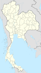
Satun
|
สตูล Satun |
||
|---|---|---|
|
|
||
| Coordinates | 6 ° 37 ′ N , 100 ° 4 ′ E | |
| Symbols | ||
|
||
| Basic data | ||
| Country | Thailand | |
| Satun | ||
| ISO 3166-2 | TH-91 | |
| Residents | 23,486 (2012) | |
Satun ( Thai : สตูล ) is a city ( เทศบาล เมือง สตูล ) in the Thai province of Satun . It is the capital of Mueang Satun County ( Amphoe ) and Satun Province.
The city of Satun has 23,486 inhabitants. (Last updated 2012)
geography
Satun Province is located on the west coast of the southern region of Thailand . The city of Satun is located at the foot of the Tenasserim Mountains and at the mouth of the Maenam Satun , which flows into the Andaman Sea here . The area around Satun consists of deserted rainforest and sandy beaches with coral banks. The city itself still offers the charm of former Thailand.
The distance to the capital Bangkok is 973 kilometers (as the crow flies about 800 kilometers).
The Tarutao National Park , which consists of the Tarutao and Adang Archipelago, is located in the county. The Thale Ban National Park lies in the border area with Malaysia .
Economy and Importance
- The main industry is fishing , the fish is processed and sold in the two seaports.
- Trade with Malaysia also adds to the city's otherwise modest income. A large part of this trade is based on smuggling, but the smugglers are well known in the city and are tolerated by the authorities.
- The city's tourist importance is low. Only a few individual travelers come to Satun because they can travel by boat to Langkawi and from there to Penang and thus save the detour via Hat Yai . Westerners in particular who stay in southern Thailand for several months use this route to renew their visa for Thailand in Penang.
Attractions
- Cityscape - in the ancient, authentic cityscape, visitors can experience ancient Thailand, including the Khao To Phaya Wang Park, which is surrounded by limestone hills and has a cave and a stream.
- Bambang Mosque - in the middle of the city
- Nature experience - in the vicinity of the city there are numerous places of idyllic beauty with caves, rocks, waterfalls and clear lakes.
- Those who let locals drive them up or down the river can get a unique insight into the way of life of the Thais from the boat, who built their houses or huts directly on the water, using the river as a source of food (fish, crabs, mussels ), as a bathroom and as a traffic route. The side of the houses facing the river is much more busy than the “official” entrance from the street.
- Although the city is several kilometers from the sea, you can feel the tides up to here, as the gradient is very small. It can happen that in the morning at the market you can see the water flowing downstream, but in the afternoon there is a current upstream at the same place.
- The Malaysian island of Langkawi can be reached from the Tam Ma Lang pier, which is five kilometers outside the city .
Personalities
- Adisak Ganu (* 1986), football player
- Yayar Kunath (* 1989), soccer player
- Seeket Madputeh (* 1989), football player
- Tanat Wongsuparak (* 1985), football player
Individual evidence
- ↑ Department of Provincial Administration : As of 2012 (in Thai)
- ↑ ThinkNet: Thailand MapMagic CD + Paper Map. Multi-Purposes Bilingual Mapping Software . Bangkok, 2009 edition, ISBN 974-88247-9-9 .
Web links
- Satun City Council website (in Thai)
- City map of Satun (names in English and Thai) [last accessed on November 17, 2013]

