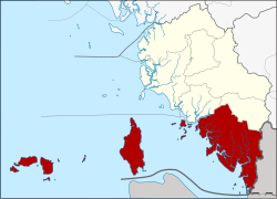
Amphoe Mueang Satun
|
Mueang Satun เมือง สตูล |
|
|---|---|
| Province: | Satun |
| Surface: | 880.2 km² |
| Residents: | 110,703 (2012) |
| Population density : | 115.4 U / km² |
| ZIP : | 91000, 91140, 91110 |
| Geocode : | 9101 |
| map | |

|
|
Amphoe Mueang Satun ( Thai : อำเภอ เมือง สตูล ) is a district ( amphoe - administrative district) in the province of Satun . The Satun Province is located in the southern region of Thailand on the west coast of the Malay Peninsula .
geography
Neighboring counties and areas (clockwise from northwest): Tha Phae and Khuan Don Amphoe of Satun Province, Perlis State of Malaysia and the Andaman Sea .
history
Originally the province of Satun consisted of two districts and one small district. Mambang ( มำ บัง ) was one of the districts, it was renamed Mueang Satun in 1938.
administration
Provincial Administration
Amphoe Mueang Satun is divided into twelve subdistricts ( tambon ) , which are further subdivided into 67 village communities ( muban ) .
| No. | Surname | Thai | Villages | Pop. |
|---|---|---|---|---|
| 1. | Phiman | พิมาน | - | 23,486 |
| 2. | Khlong Khut | คลอง ขุด | 7th | 18,690 |
| 3. | Khuan Khan | ควน ขัน | 6th | 7,287 |
| 4th | Ban Khuan | บ้าน ควน | 7th | 10,461 |
| 5. | Chalung | ฉ ลุง | 14th | 12,898 |
| 6th | Ko Sarai | เกาะ สาหร่าย | 7th | 5,146 |
| 7th | Tanyong Po | ตันหยง โป | 3 | 2,946 |
| 8th. | Che Bilang | เจ๊ะ บิ ลัง | 6th | 9,922 |
| 9. | Tam Malang | ตำ มะ ลัง | 3 | 4,937 |
| 10. | Puyu | ปู ยู | 3 | 3,002 |
| 11. | Khuan Pho | ควน โพธิ์ | 6th | 5,685 |
| 12. | Ketri | เก ตรี | 6th | 6.243 |
Local administration
Satun ( เทศบาล เมือง สตูล ) is a city ( Thesaban Mueang ) , it consists of the entire Tambon Phiman.
There are also three small towns ( Thesaban Tambon ) in the district:
- Che Bi Lang ( เทศบาล ตำบล เจ๊ะ บิ ลัง ) consists of parts of the tambon Che Bi Lang,
- Chalung ( เทศบาล ตำบล ฉ ลุง ) consists of parts of the tambon Chalung,
- Khlong Khut ( เทศบาล ตำบล คลอง ขุด ) consists of the entire tambon Khlong Khut.
There are also ten "Tambon Administration Organizations" (TAO, องค์การ บริหาร ส่วน ตำบล ) for the Tambon or the parts of Tambon in the county that do not belong to any town.
Individual evidence
- ↑ พระราชกฤษฎีกา เปลี่ยน นาม จังหวัด และ อำเภอ บาง แห่ง พุทธศักราช ๒๔๘๑ Royal Gazette, Volume 55, Ed. 0 ก of November 14, 1938, p. 658 (in Thai)
- ↑ Population statistics 2012 . Department of Provincial Administration. Retrieved July 13, 2014.
Web links
Coordinates: 6 ° 37 ' N , 100 ° 4' E
