Has yai
|
หาดใหญ่ Hat Yai |
||
|---|---|---|
|
|
||
| Coordinates | 7 ° 1 ′ N , 100 ° 28 ′ E | |
| Symbols | ||
|
||
| Basic data | ||
| Country | Thailand | |
| Songkhla | ||
| ISO 3166-2 | TH-90 | |
| Residents | 157,359 (2008) | |
| Website | www.hatyaicity.go.th/index.php | |
| politics | ||
| mayor | Prai Pattano | |
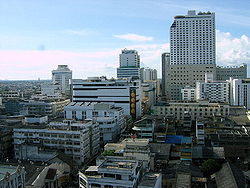
Hat Yai (also Haad Yai , Thai : หาดใหญ่ ) is the largest city in southern Thailand . It is located in Songkhla Province and is the capital of Hat Yai County ( Amphoe ) . Since 1995 it has had the status of a major city ( Thesaban Nakhon ) .
The name Hat Yai is derived from Mahat Yai ( มะ หาดใหญ่ ), which translates as "Great Mahat Tree" ( Artocarpus lacucha ) .
geography
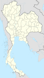
The city is located in the south of the country, about 55 kilometers from the border with Malaysia and 30 kilometers from the provincial capital Songkhla on the Gulf of Thailand. With about 157,359 inhabitants (2008 population statistics) Hat Yai is the largest city in Songkhla Province, but not its capital. It is even the largest city in the entire southern region of Thailand. In addition, the core city of Hat Yai has a very densely populated area: Another 45,052 people live in the suburb of Kho Hong, 41,548 in Khuan Lang, and 31,603 in Khlong Hae.
traffic
The city is located on the southern runway of the Thai State Railways , which runs from Bangkok through Malaysia to Singapore . Hat Yai International Railway Station is the largest in southern Thailand . Here 28 trains are handled per day, 26 trains of the SRT ( State Railway of Thailand ) and two (Ekspres Langawi) of the Malaysian KTMB .
Hat Yai International Airport ( IATA code : HDY) is on the outskirts .
history
Until it was connected to the railway network in 1922, Hat Yai was just a small town, originally called Khok Samet Chun . At that time Khok Samet Chun had only four residents, but through investments from Khun Niphat-Chin-Nakhon (Thai: ขุน นิพัทธ์ จีน นคร , Chinese 謝 枢 泗 , Jia Gi Si, born October 30, 1886, † December 10, 1972, a Hokkien -Chinese, entrepreneur for the railway connection from Nakhon Si Thammarat to Pattani) it quickly grew into a small town.
The junction of the Bangkok - Padang Besar (Malaysia) railway to Songkhla was originally at Khlong U Tapao, about 3 km north of today's Hat Yai. Since this place was often exposed to flooding, the RSR ( Royal Siamese Railway , today's State Railway of Thailand ) relocated the branch to the current location, U Tapao was "demoted" to the railway station to Songkhla on July 1, 1978 the railway line to Songkhla completely closed. Remnants of the track system can still be seen today.
From 1922 onwards, Hat Yai grew steadily, largely due to its role as a trading center in the flourishing rubber trade . It was first declared a Sukhaphiban (sanitary district) in 1928 and a Thesaban Tambon (small town) in 1935 . In 1949 it was given city status ( Thesaban Mueang ) , and in 1995 it was upgraded to city status ( Thesaban Nakhon ) .
Hat Yai is culturally clearly influenced by the ethnic group of Thai people of Chinese origin . While the “ Thaiization ” policy initially pushed them to deny their own ethnic heritage and to assimilate, an increased emancipation and a return to their own roots can be observed since the economic boom of the 1980s. Outwardly visible in Hat Yai is the statue of the female Bodhisattva Guanyin and the celebration of Thesakan Kin Che (“vegetarian festival of the nine emperor gods ”) on nine days from late September to early October.
Tourism has also contributed significantly to the prosperity of Hat Yai. A significant number of the visitors come from Malaysia. Sex tourism also plays an important role here, as prostitution is much more strictly prosecuted in Malaysia than in Thailand.
On December 2, 1989, the Hat Yai Agreement between the Malay Communist Party and the Malaysian government and the Thai army was concluded here, according to which the former gave up their armed struggle.
Educational institutions
Hat Yai is home to the Prince of Songkla University's largest campus . There has also been a Mahayana Buddhist college , the Mahapanya Vidayalai, since 2002 .
Sports
The Chira Nakhon Stadium is located in Hat Yai.
Individual evidence
- ↑ a b c History of the City ( Memento of January 17, 2013 in the Internet Archive ) (Internet Archives; in English)
- ^ Marc Askew: Materializing merit. The symbolic economy of religious monuments and tourist pilgrimage in contemporary Thailand. In: Religious Commodifications in Asia. Marketing Gods. Routledge, Abingdon / New York 2008, pp. 115-116.
- ↑ Marc Askew: Sex and the sacred. Sojourners and visitors in the making of the Southern Thai Borderland. In: Centering the Margin. Agency and Narrative in Southeast Asian Borderlands. Berghahn, 2006, p. 193.
- ^ Karl Hack: The Long March to Peace of the Malayan Communist Party in Southern Thailand. In: Thai South and Malay North. Ethnic Interactions on the Plural Peninsula. NUS Press, Singapore 2008, p. 195.
Web links
- Virtual walk along the old Hat Yai - Songkhla railway line ( memento of March 16, 2005 in the Internet Archive ) (in English)
- The Songkhla Bullet, the last train from Hat Yai to Songkhla (English)
- About history:
- Full history of Hat Yai in forum posts at angkor.com ( Memento from April 6, 2008 in the Internet Archive )
- The story of Khun Niphat-Chin-Nakhon at khlong-u-tapao.com (Thai)


