Phetchabun Mountains
| Phetchabun Mountains | ||
|---|---|---|
| Highest peak | Phu Thap Buek ( 1794 m ) | |
| location | Thailand | |
|
|
||
| Coordinates | 16 ° 26 ' N , 101 ° 9' E | |

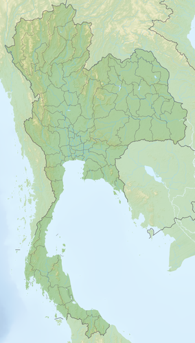
The Phetchabun Mountains ( Thai : ทิว เขา เพชรบูรณ์ , Thio Khao Phetchabun , tʰiw kʰǎw pʰét.tɕʰa.buːn ) form a mountain range in northern Thailand . It extends roughly in a north-south direction and separates the Mae Nam Chao Phraya valley in central Thailand from the Khorat plateau in the northeast of the country. The mountain range is named after the nearby city and province of Phetchabun .
The Phetchabun Mountains consist of two parallel mountain ranges that are separated by the valley of the Pa Sak River , the western Khao-Lang-Non-Son and the Dong-Paya-Yen mountain range east of the Pa Sak . To the south the Dong Phaya Yen closes, to the southeast it goes into the mountains of the Sankamphaeng ( ทิว เขา สันกำแพง ), where the Khao Yai National Park is located. These continue further east in the Phnom-Dangrek mountain range that separates Thailand from Cambodia .
The highest point is at a height of 1794 meters in the Phu Hin Rong Kla National Park , in the western part of the mountain range. In the northern part are the Namtok Chat Trakan National Park and the Thung Salaeng Luang National Park .
Geologically , the mountains consist of limestone interspersed with sandstone and slate . There are also igneous rocks such as granite , basalt and porphyry .
Until recently the ridge, together with the Dong Phaya Yen and the Sankamphaeng Mountains, formed a natural barrier between central Thailand and Isan . It was only when the railroad from the capital Bangkok to Nakhon Ratchasima was built at the beginning of the 20th century and later a highway was added that the exchange of goods and services became possible on a larger scale.
literature
- Wolf Donner: The Five Faces of Thailand . Institute of Asian Affairs, Hamburg 1978, Paperback Edition: University of Queensland Press, St. Lucia, Queensland 1982, ISBN 0-7022-1665-8


