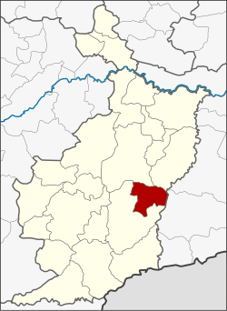
Amphoe Phlapphla Chai
|
Phlapphla Chai อำเภอ พลับพลา ชัย |
|
|---|---|
| Province: | Buri Ram |
| Surface: | 320.1 km² |
| Residents: | 44,041 (2013) |
| Population density : | 113,822.3 U./km² |
| ZIP : | 31250 |
| Geocode : | 3115 |
| map | |

|
|
Amphoe Phlapphla Chai ( Thai : อำเภอ พลับพลา ชัย ) is a district ( amphoe - administrative district) of Buri Ram Province . The province of Buri Ram is located in the northeast region of Thailand , the so-called Isan .
geography
Neighboring districts (clockwise from the south): Amphoe Prakhon Chai , Amphoe Mueang Buri Ram , Krasang in Buri Ram province and Amphoe Prasat in Surin province .
history
Phlapphla Chai was initially set up on April 1, 1989 as a "branch circle" ( King Amphoe ) by separating five tambon from the Prakhon Chai district . On July 4, 1994, it was promoted to Amphoe.
administration
Provincial Administration
The district of Phlapphla Chai is divided into five tambon ("sub-districts" or "communities"), which are further subdivided into 67 muban ("villages").
| No. | Surname | Thai | Muban | Pop. |
|---|---|---|---|---|
| 1. | Chan Dum | จัน ดุม | 18th | 10,442 |
| 2. | Khok Khamin | โคก ขมิ้น | 15th | 9,456 |
| 3. | Pa Chan | ป่า ชัน | 10 | 6,066 |
| 4th | Sadao | สะเดา | 13 | 9,849 |
| 5. | Samrong | สำโรง | 11 | 8,228 |
Local administration
There are two municipalities with "small town" status ( Thesaban Tambon ) in the district:
- Phlapphla Chai (Thai: เทศบาล ตำบล พลับพลา ชัย )
- Chan Dum (Thai: เทศบาล ตำบล จัน ดุม )
There are also four " Tambon Administrative Organizations " ( องค์การ บริหาร ส่วน ตำบล - Tambon Administrative Organizations, TAO):
- Khok Khamin (Thai: องค์การ บริหาร ส่วน ตำบล โคก ขมิ้น )
- Pa Chan (Thai: องค์การ บริหาร ส่วน ตำบล ป่า ชัน )
- Sadao (Thai: องค์การ บริหาร ส่วน ตำบล สะเดา )
- Samrong (Thai: องค์การ บริหาร ส่วน ตำบล สำโรง )
Individual evidence
- ↑ ประกาศ กระทรวง มหาดไทย เรื่อง แบ่ง ท้องที่ อำเภอ ประโคน ชัย จังหวัด บุรีรัมย์ ตั้ง เป็น กิ่ง อำเภอ พลับพลา ชัย . In: Royal Gazette . 106, No. 40 ง , March 14, 1989, p. 1887.
- ↑ พระราชกฤษฎีกา ตั้ง อำเภอ เปือยน้อย ... และ อำเภอ ศรีวิไล พ.ศ. ๒๕๓๗ . In: Royal Gazette . 111, No. 21 ก , June 3, 1994, pp. 32-35.
- ↑ 2013 population statistics . Department of Provincial Administration. Retrieved July 25, 2014.
Web links
Coordinates: 14 ° 44 ' N , 103 ° 10' E
