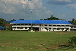
Amphoe Phanom
|
Phanom พนม |
|
|---|---|
| Province: | Surat Thani |
| Surface: | 707.6 km² |
| Residents: | 37,460 (2012) |
| Population density : | 47.4 U / km² |
| ZIP : | 84250 |
| Geocode : | 8410 |
| map | |

|
|
Amphoe Phanom ( Thai : อำเภอ พนม ) is a district ( Amphoe - administrative district) in the southwest of Surat Thani Province . The Surat Thani Province is located in the southern region of Thailand .
geography
The district is located in the Phuket mountain range, with about 60% of the area being mountainous and forested areas. The north-west of the district is protected by the Khao Sok National Park , while the Khlong Phanom National Park is in the south-west.
In Phanom is the eastern end of the mountain pass that connects Takua Pa with Surat Thani. The historic pass in the valley of the Sok River is used today by Highway 401 , which connects Phang Nga Province to Nakhon Si Thammarat via Surat Thani .
The neighboring amphoe and areas are (from the north clockwise): the amphoe Ban Ta Khun , Khiri Rat Nikhom , Khian Sa and Phrasaeng in the province of Surat Thani, Amphoe Plai Phraya in the province of Krabi and the amphoe Thap Put , Amphoe Mueang Phang Nga , Kapong , Takua Pa and Khura Buri of Phang Nga Province .
history
The district was established in 1890 as Khlong Cha Un ( คลอง ชะ อุ่น ). The chairman of the administration at that time was Khun Phanom Thana Rak. In 1910 the district was reduced to a subdistrict ( King Amphoe ) and renamed Phak Phanom ( ปาก พนม ) because a new administration building had been built in Phak Phanom. The name was later simplified to Phanom. It got its full amphoe status on November 14, 1971.
administration
Provincial Administration
Amphoe Phanom is divided into six subdistricts ( tambon ) , these in turn have a total of 56 communities ( muban ) .
|
Local administration
There are two small towns ( Thesaban Tambon ) in the county:
- Phanom ( เทศบาล ตำบล พนม ) consists of parts of the Tambon Phang Kan and Phanom,
- Khlong Cha-un ( เทศบาล ตำบล คลอง ชะ อุ่น ) consists of the entire Tambon Khlong Cha-un.
There are also four "Tambon Administrative Organizations " ( องค์การ บริหาร ส่วน ตำบล - Tambon Administrative Organizations, TAO) for the Tambon or the parts of Tambon in the district that do not belong to any city.
Individual evidence
- ↑ แจ้ง ความ กระทรวง มหาดไทย เรื่อง ยุบ อำเภอ พนม แขวง เมือง ไชยา ลง เป็น กิ่ง อำเภอ ขึ้น อยู่ ใน อำเภอ คิรี รัฐ นิคม . In: Royal Gazette . 27, No. 0 ง , July 17, 1910, p. 688.
- ↑ พระราชกฤษฎีกา ตั้ง อำเภอ ปลาปาก อำเภอ เชียงกลาง อำเภอ ปากชม อำเภอ บ้านม่วง อำเภอ พังโคน อำเภอ ดอนสัก อำเภอ พนม อำเภอ เวียงสระ อำเภอ สังคม และ อำเภอ หัวตะพาน พ.ศ. ๒๕๑๔ . In: Royal Gazette . 88, No. 123 ก , November 16, 1971, pp. 745-748.
- ↑ Population statistics 2012 . Department of Provincial Administration. Retrieved February 1, 2014.
Web links
Coordinates: 8 ° 51 ' N , 98 ° 49' E


