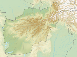
Kohe Chrebek
| Kohe Chrebek | ||
|---|---|---|
| height | 6290 m | |
| location | Badakhshan ( Afghanistan ) | |
| Mountains | Hindu Kush | |
| Coordinates | 35 ° 55 '49 " N , 71 ° 4' 46" E | |
|
|
||
| First ascent | 1961 by a German expedition | |
The Kohe Chrebek (also Koh-e-Chrebek or Koh-i-Chrebek ; "Snow Bird Summit") is a 6290 m high mountain in the Hindu Kush in Afghanistan .
location
The Kohe Chrebek is located in the Badachschan Province . The mountain is located in the central section of the Hindu Kush. Its western flank is drained by the Mundschan running to the west , the right source river of the Koktscha . The eastern flank belongs to the catchment area of the Bashgal , a right tributary of the Kunar .
Ascent history
The Kohe Chrebek was first climbed in 1961 by a German mountaineering group from Bremen under the leadership of Josef Ruf.
Individual evidence
- ^ Alpine Club Library - Himalayan Index
- ↑ americanalpineclub.org
- ^ Asia, Afghanistan, Bremen Hindu Kush Expedition . American Alpine Journal, 1962, vol. 13.
- ^ Asia, Afghanistan, Hindu Kush . American Alpine Journal, 1965, vol. 14th
