Kolkhozny
| Village
Kolchosny
Колхозный
|
||||||||||||||||||
|
||||||||||||||||||
|
||||||||||||||||||
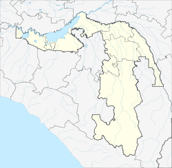
Kolkhozny ( Russian Колхозный ) is a village (chutor) in southern Russia . It belongs to the Adygeja and has 78 inhabitants (as of 2019). There are 2 streets in the village.
geography
The village in the southeast of Giaginski Rajon on the left bank of the river Gatschutscha, 8 km southwest of the village Sergijewskoje , 37 km southeast of the village Giaginskaya and 26 km northeast of the city of Maikop . Michelsonowski , Dneprovski , Krasny Pachar are the nearest settlements.
Individual evidence
- ↑ Численность постоянного населения по МО и населенным пунктам Республики Адыгея по состоянию воад 1. 2019
- ↑ Карта хутора Колхозный в Республике Адыгее

