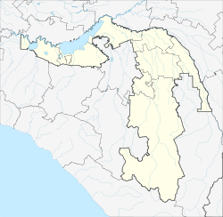
Giaginskaya
Staniza
|
||||||||||||||||||||||||||||||||||
|
||||||||||||||||||||||||||||||||||
|
||||||||||||||||||||||||||||||||||
| List of large settlements in Russia | ||||||||||||||||||||||||||||||||||
Giaginskaya ( Russian Гиагинская , Adyghe Джаджэ ) is a Staniza in the Republic of Adygea ( Russia ) with 14 121 inhabitants (14 October 2010).
geography
The settlement is situated in the northern foothills of the Greater Caucasus , about 30 km as the crow north of the Republic capital Maikop at Giaga, a left tributary of the Kuban -Zuflusses Laba .
Giaginskaya is the administrative center of the Rajons Giaginski . The rural community of Giaginskoje selskoje posselenije includes the Stanitsa also the settlements Goncharka (11 km southwest) and Cheryomushkin (8 km south) and the village Pervomaiski (9 km north).
history
The Staniza Giaginskaja was founded in 1862 by Kuban Cossacks and initially belonged to the line of defense along the then southern border of the Russian Empire .
At the end of 1934 Stanitsa became the center of a newly created Rajon in what was then the Azov-Black Sea region as part of an administrative reform . In 1936, when it was founded, the Rajon was transferred to the Adygeian Autonomous Region , the forerunner of today's republic.
Population development
| year | Residents |
|---|---|
| 1939 | 8,259 |
| 1959 | 10,248 |
| 1970 | 13,647 |
| 1979 | 14,057 |
| 1989 | 14,522 |
| 2002 | 15,160 |
| 2010 | 14,121 |
Note: census data
Economy and Infrastructure
Giaginskaja is the center of an agricultural area in which mainly fruit and vegetables are grown and poultry and sheep are raised. There are a number of companies in the food industry.
The settlement is located on the single-track, electrified railway line Armavir - Tuapse of the North Caucasian Railway (route km 1733 from Moscow ; km 81 from Armavir). The regional road R256 leads through the village, starting from Maikop, which first opens up the central part of the republic to the left of the Laba - in addition to Giaginskaya other larger towns such as Chakurinochabl and Koschechabl - and then past the city of Labinsk through the neighboring Krasnodar region into the Republic of Karachay-Cherkessia where it ends south of Ust-Dscheguta on the A155 highway .
Individual evidence
- ↑ a b Itogi Vserossijskoj perepisi naselenija 2010 goda. Tom 1. Čislennostʹ i razmeščenie naselenija (Results of the All-Russian Census 2010. Volume 1. Number and distribution of the population). Tables 5 , pp. 12-209; 11 , pp. 312–979 (download from the website of the Federal Service for State Statistics of the Russian Federation)
- ↑ Giaginskaja on the website of the Geographical Institute of the RAN (Russian)


