Chakurinochabl
Aul
|
||||||||||||||||||||||||||||||
|
||||||||||||||||||||||||||||||
|
||||||||||||||||||||||||||||||
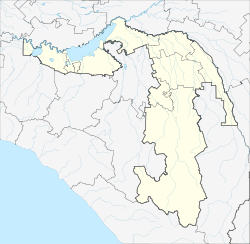
Khakurinokhabl ( Russian Хакуринохабль ; Adyghe Хьэкурынэхьабл ) is Aul in the Republic of Adygea ( Russia ) with 4038 inhabitants (as of October 14, 2010).
geography
The place is on the right bank of the Fars , a left tributary of the Laba , about 50 km as the crow flies north of the republic capital Maikop .
Khakurinokhabl is the administrative center of the Rajons Schowgenowski and seat of the rural community Chakurinochablskoje selskoje posselenije, which in addition to the Aul nor the hamlet (Khutor) include Chapatschew and Kirov.
history
The place was founded in 1863. In 1922 he was the administrative seat of an okrug , in 1924 a Rajon, which was named in 1929 after the Adygeic Bolshevik Mos Schowgenow (1876-1918). Zhovgenov was shot dead in Chakurinochabl won by White Guards during the Russian Civil War . In 1958, the Aul and the Rajon were also given the name Schowgenowski. In 1996 it was renamed, with the Rajon keeping its name.
Population development
| year | Residents |
|---|---|
| 1939 | 2865 |
| 1959 | 3304 |
| 1970 | 4265 |
| 1979 | 4254 |
| 1989 | 4101 |
| 2002 | 3828 |
| 2010 | 4038 |
Note: census data
traffic
The regional road R256 runs through Chakurinochabl, which starts from Maikop and opens up the central part of the republic to the left of the Laba and then leads past the city of Labinsk through the neighboring Krasnodar region to the republic of Karachay-Cherkessia , where it leads south of Ust-Jeguta on the A155 highway ends.
Sons and daughters of the place
- Khussen Andruhayev (1920–1941), Adygean poet, Hero of the Soviet Union
- Daud Aschchamaf (1897–1946), Adygean linguist and folklorist
Individual evidence
- ↑ a b Itogi Vserossijskoj perepisi naselenija 2010 goda. Tom 1. Čislennostʹ i razmeščenie naselenija (Results of the All-Russian Census 2010. Volume 1. Number and distribution of the population). Tables 5 , pp. 12-209; 11 , pp. 312–979 (download from the website of the Federal Service for State Statistics of the Russian Federation)

