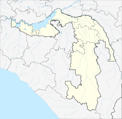
Tljustenchabl
Urban-type settlement
|
||||||||||||||||||||||||||||
|
||||||||||||||||||||||||||||
|
||||||||||||||||||||||||||||
Tlyustenkhabl ( Russian Тлюстенхабль ; Adyghe Лъэустэнхьабл ) is an urban-type settlement in the Republic of Adygea ( Russia ) with 5403 inhabitants (as of October 14, 2010).
geography
The place is about 90 km as the crow flies northwest of the republic capital Maikop and about 10 km southeast of the center of Krasnodar , the administrative center of the neighboring Krasnodar region . It is located on the left bank of the Kuban , immediately below (west) the more than 10 km long dam of the Krasnodar reservoir , not far from its northern end.
Tljustenchabl belongs to the Teutscheschski Rajon and is located about 25 km northwest of its administrative seat Poneschukai . It is the seat of the municipality of Tlyustenchablskoje gorodskoje posselenije, to which, in addition to the settlement, the Aul Tugurgoi and the settlement of Cheetuk-2 also belong.
history
Tljustenchabl was founded as Adygeischer Aul in 1840. In connection with the construction of the Krasnodar reservoir, it was expanded in the early 1970s next to the newly built city of Adygeisk (1976-1992 Teutscheschsk ) , 13 km to the south, to one of the places to which the residents of the villages to be flooded were resettled. On February 28, 1973 it was given urban-type settlement status.
Population development
| year | Residents |
|---|---|
| 1979 | 4137 |
| 1989 | 3869 |
| 2002 | 4961 |
| 2010 | 5403 |
Note: census data
traffic
To the east of Tlyustenchabl, the M4 trunk road , which connects Moscow with Novorossiysk on the Black Sea coast , runs across the dam of the Krasnodar reservoir .
Individual evidence
- ↑ a b Itogi Vserossijskoj perepisi naselenija 2010 goda. Tom 1. Čislennostʹ i razmeščenie naselenija (Results of the All-Russian Census 2010. Volume 1. Number and distribution of the population). Tables 5 , pp. 12-209; 11 , pp. 312–979 (download from the website of the Federal Service for State Statistics of the Russian Federation)

