Krasnodar Reservoir
| Krasnodar Reservoir Cuban Sea |
|||||||||
|---|---|---|---|---|---|---|---|---|---|
| View of the Krasnodar Reservoir from the south | |||||||||
|
|||||||||
|
|
|||||||||
| Coordinates | 44 ° 59 '36 " N , 39 ° 17' 38" E | ||||||||
| Data on the structure | |||||||||
| Lock type: | Earthfill dam | ||||||||
| Construction time: | 1968-1973 | ||||||||
| Crown length: | 11.6 km | ||||||||
| Operator: | Kubanskoje Bassejnovoye Vodnoye Uprawlenie (Kuban Basin Water Board ) | ||||||||
| Data on the reservoir | |||||||||
| Altitude (at congestion destination ) | 32.75 m | ||||||||
| Water surface | 420 km² | ||||||||
| Reservoir length | 46 km | ||||||||
| Reservoir width | 15 km | ||||||||
| Maximum depth | 18 m (mean depth 5 m) | ||||||||
| Storage space | 2 200 000 000 m³ | ||||||||
| Total storage space : | 2 794 000 000 m³ | ||||||||
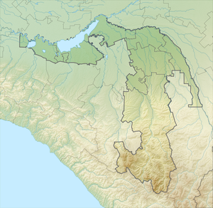
The Krasnodar Reservoir ( Russian Краснодарское водохранилище / Krasnodarskoje wodochranilischtsche ), also Cuban Sea ( Russian Кубанское море / Kubanskoje more ), is a dam in Russian Kuban basin that the flood control and irrigation for rice cultivation is used. Most of the lake, which was dammed in the 1970s, is in the Adygea Republic , and a small part in the Krasnodar Territory .
history
To the east of Krasnodar was a floodplain landscape traversed by the Kuban and inhabited by Circassians . The swampy area was a breeding ground for malaria mosquitoes that repeatedly among the local population malaria triggered -Epidemien. Floods in the river prevented agriculture and caused damage in Krasnodar.
In 1940 the construction of the Chechik Reservoir ( Russian Тщикское водохранилище ) began - a first attempt to tame the water masses of the Kuban. The barrage was at the level of the Wasjurinskoi station ( Russian Васюринской ) and dammed the Beloi ( Russian Белой ), a left tributary of the Kuban. The hand-built dam was unable to cope with the floods of 1966. It broke in several places so that 300,000 hectares of cultivated land were flooded.
In July 1967 the Council of Ministers of the USSR decided to build a new, larger reservoir on the Kuban. Construction of the dam began on April 3, 1968. 13,000 people had to be resettled, living in twelve fully flooded villages and ten partially flooded villages. Most were settled in the newly established Adygeisk and in Tlyustenchabl . The damming of the lake began in 1973 and the work was officially completed in late 1975.
In 2019, the renewal of the locks in the main barrier was approved. The barrier structure is equipped with a fish lift .
Web links
- ФГУ "Краснодарское водохранилище". Federal authority Krasnodar Reservoir (operator of the reservoir). (ru-RU).
Individual evidence
- ↑ Зачем Адыгее «Кубанское море»? - Общественно-политический портал Адыгеи. Why the Adygean "Cuban Sea"? In: Adygeja Social and Political Portal. November 14, 2016 (ru-RU).
- ↑ a b Vitali Stybin: Утерянное наследие Адыгеи. Какой ценой построили Краснодарское водохранилище. Lost inheritance of Adygea. What is the cost of building the Krasnodar storage facility? In: yuga.ru. July 13, 2018 (Russian).
- ↑ Второй период (1930-1965). History part 2 (1930-1940). Федеральное Государственное Бюджетное Учреждение "Управление" Кубаньмелиоводхоз ", accessed August 4, 2019 (Russian).
- ↑ Council of Ministers of the USSR: Decree on the planning task for the construction of the Krasnodar reservoir on the Kuban . July 22, 1967 ( consultant.ru ).
- ↑ Julija Weselowa: Утверждена смета реконструкции шлюза Краснодарского водохранилища. Approval of the cost estimate for the reconstruction of the lock of the Krasnodar reservoir. AI News, February 13, 2019 (Russian).
- ^ Stephan Heimerl: Biological continuity of rivers: Selected articles from the journal WasserWirtschaft . Springer-Verlag, 2017, ISBN 978-3-658-13990-2 ( google.ch ).

