Kranenholl
|
Kranenholl
City of Remscheid
Coordinates: 51 ° 11 ′ 54 ″ N , 7 ° 12 ′ 34 ″ E
|
||
|---|---|---|
| Height : | 245 m above sea level NN | |
| Area code : | 02191 | |
|
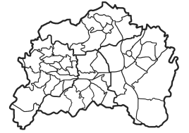
Location of Kranenholl in Remscheid |
||
|
Kranenholl farm on the slope of the Goldenberg
|
||
Kranenholl is a court in the north of the North Rhine-Westphalian city of Remscheid .
location
The Hofschaft is located in the district of Lüttringhausen on the northwest slope of the Goldenberg . The access road branches off from Remscheider Straße. The name used to be popularly "Em Kradenholl" or "Kradenpuohl" in Low German.
The farm, which was used for agriculture until the end of the 20th century, once belonged to an iron hammer in the Leyerbach valley . It stood on swampy terrain, which is why there were many toads and frogs here. Explanations for the origin of the name are all to be explained in dialect: "Krat" means "toad", "Hohl" or "Holl" stands for a deep valley and "Puohl" for "Pfuhl" or "Pümpel". From this Kradenholler Hammer, formerly located above the Birgder Hammer, only a fallow and meadow area is left.
At the level of Kranenholl there are green spaces that represent a wide swath and at the same time the only remaining biological connection between the Leyerbachtal, the Diepmannsbachtal nature reserve and on to Hohenhagen. For reasons of nature conservation, this ecological bridge should definitely be preserved. A woman from Lüttringhausen ensured that the area was not built on, but kept as a green area.
history
From the farm two hundred meters down the valley, on the current Leyerbach, was the Kranenholler Hammer. The first forge with three water wheels including ancillary buildings and a small residential house were built on this site around 1500, but fell into disrepair a good 100 years later. In 1597 the area was called "Cradenholl", later "Kradenholl" and only in the 20th century after 1900 the name "Kranenholl" was used. Other names were the following: Kradenholler Hammer, Kranenholler Hammer, Jarres Hammer, Schrotthammer, Schruoden Hammer.
In the "Hämmer- und Kottenforschung in Remscheid" it says about the further history: "On August 30th, 1677" Joann auf der Halbach "received the permission to" put an Eysenhammer on seyn guth in Kradenholl on the Halbacher Bach " His son Peter Halbach had lived at the Kradenholl estate he had acquired from his father since 1671. Peter Halbach worked as a journeyman in this Kradenholler iron reckhammer (refining steel hammer) from 1680 to 1686. At that time nobody dared to dream what a famous empire these Halbachs would later hold (Krupp von Bohlen und Halbach). The hammer had crumbled as early as 1910; it collapsed completely in 1913. After that, the foundation walls could still be seen for a long time. According to tradition, in 1913 the dilapidated half-timbered house (as a residential house) housed a small snap pin The location also passes the former coal route (coal and pig iron from the Märkisches) ".
literature
- Gustav Hermann Halbach: Bergischer Sprachschatz. 1951.
- Hans Kadereit: Wherever there is still a celebration, coiling and pounding. A historical illustrated book. RGA-Buchverlag, Lüttringhausen 2009, ISBN 978-3-940491-07-7
- Rolf Lotzmann: Remscheid - a lost cityscape . Wartberg-Verlag, 1994.
- Günther Schmidt: Hammer and Kotten research in Remscheid Volume 4 - Leyerbach, Diepmannsbach, Müggenbach.

